Manaslu Circuit Tsum Valley Trek – 19 Days

Quick Facts
  • Trip Duration19 Days
  • Destination Nepal
  • Difficulty Level Strenuous
  • Maximum Altitude 5,106 m (Larkya La Pass)
  • Activity Trek
  • Starts/Ends Kathmandu / Kathmandu
  • Group Size 1 - 16
  • Transportation Private Vehicle Drive
  • Best Season Spring (March – May), and Autumn (September – November)
  • Accommodation Teahouse and Lodge
  • Avg. hours of walk/day 5 – 7 hours
  • Comfort Standard to basic
  • Interest option Trekking and Adventure

Manaslu Circuit Tsum Valley Trail Psychology

How You Feel During the Trek

Wonder → Commitment → Grit → Acceptance → Fulfillment → Gratefulness

  • Wonder: The trail breaks away from the busy highway and enters the steep gorges of the Budhi Gandaki River. Walking into the hidden Tsum Valley brings an immediate sense of mystery.
  • Commitment: When you reach the sacred caves and old monasteries of Mu Gompa and Rachen Gompa, your mind shifts to a state of deep reflection. You commit fully to the long foot journey ahead.
  • Grit: As you reenter the main Manaslu Circuit and climb toward Samdo and Dharamsala, the mountain air gets thin and cold. The route tests your physical endurance and mental patience. But this struggle builds deep resilience.
  • Acceptance: When you rest in the high alpine shelters before the pass, your body accepts the raw nature of high altitude. You prepare your mind for the freezing temperatures.
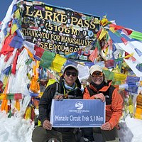
  • Fulfillment: As you stand at the summit of Larkya La Pass at 5,106 m, you feel a massive wave of achievement. You have overcome the toughest barrier of the circuit.
  • Gratefulness: As you walk through the green forests of Bhimthang and Goa, your legs are heavy. But your mind is completely calm and full of gratefulness.

Emotions you will feel

  • Inspired
  • Humbled
  • Resilient
  • Grounded

How your mind changes

  • When the trek starts: You feel a sense of mystery as you leave the city hub and enter the remote river gorges.
  • In the middle: You feel a deep connection to the ancient Tibetan culture and isolated Buddhist communities in Tsum Valley.
  • Near the high points: You feel intensely focused as the air thins and the massive peaks appear. Also, the thin air forces you to slow down your thoughts.
  • At the highest pass: You feel a profound sense of inner power and humility at 5,106 m.
  • Coming back: You feel mentally refreshed, emotionally grounded, and deeply satisfied with your achievement.

Connection and solitude ratio

  • Connection level: 60% (Kathmandu to Chumling)
  • Solitude level: 40% (Chhokangparo to Larkya La Pass)

Why You'll Love This Trip

  • Enjoy the captivating beauty of Mount Manaslu, the eighth-highest mountain in the world.
  • Experience an offbeat trekking route that promises serenity and adventure.
  • Discover the Tsum Valley, a pristine and untouched paradise hidden in the mountains.
  • Immerse yourself in authentic Tibetan Buddhism and witness the daily life of the welcoming locals.
  • Explore the sacred Milarepa Piren Phu Cave, a mystical cave located in the Tsum Valley.
  • Visit ancient monasteries like Mu Gompa, Rachen Gompa, and Gompa Lungdang.
  • Pass through picturesque villages, lush forests, rolling hills, and verdant valleys.
  • Challenge yourself by crossing the formidable Larkya La pass.
  • Hike to Ganesh Himal Base Camp and Manaslu Base Camp, and experience majestic views of the Manaslu region.
  • Enjoy the quiet and peaceful atmosphere of Birendra Lake.

Manaslu Circuit Tsum Valley Trek Overview

The Manaslu Circuit Tsum Valley Trek takes you through the protected Manaslu Conservation Area. This region shelters rare wildlife, including snow leopards, Himalayan tahr, and red pandas. Along the trail, you will walk through villages rooted deeply in Tibetan Buddhism. The local communities live on limited resources but welcome travelers with genuine hospitality. At 19 days, this long journey demands good physical fitness because you will face high altitudes and remote conditions. But the opportunity to explore ancient monasteries and intact culture makes it a premier choice for seasoned trekkers.

The route splits from the main Manaslu trail into the sacred Tsum Valley, known as the Hidden Valley of Happiness. Hence, many experienced guides have given the name Manaslu and Tsum Valley Trek. You will hike through dense pine forests and follow the roaring Budhi Gandaki River. The terrain changes quickly from subtropical lowlands to alpine valleys. You must cross the challenging Larkya La Pass at 5,106 m, where weather changes rapidly, and high winds are common. For this trek, you cannot travel entirely alone. Restricted-area regulations require solo trekkers to hire a licensed guide to access both the Tsum Valley and the Manaslu region.

Proper acclimatization is mandatory to complete this route safely. Altitude sickness is a real risk as you climb past 3,000 m into the high-altitude zone. You need to prepare your body with regular cardio and strength training months before arrival. Likewise, you should pack thermal gear that handles freezing temperatures at higher elevations. Our itinerary builds in rest days to help your body adapt to the thinning air. Your safety depends on following your guide's advice and listening to your body on the trail.

Flow of Journey

This 19-day itinerary takes you on a profound journey through two distinct, high-altitude worlds, from the lush subtropical lowlands to a dramatic alpine crossing. The first half of the expedition focuses on the hidden valley of Tsum, where the trail gradually climbs alongside terraced fields and enters a deeply secluded Buddhist enclave. As we transition from Lower to Upper Tsum, the landscape opens into wide alpine pastures dotted with ancient monasteries like Mu Gompa and sacred meditation sites like Milarepa’s Cave. This segment is characterized by a slower, culturally rich pace, allowing our bodies to naturally adapt to the rising elevations before we retrace our steps down the valley to rejoin the main route.

The second half of the trek shifts the journey into a more rugged, classic Himalayan loop as we merge back onto the main Manaslu Circuit trail. Moving through dense bamboo and pine forests, we climb steadily past high-altitude trading villages like Lho and Samagaon, where the jaw-dropping, close-up massifs of Mount Manaslu dominate the skyline. The physical climax of the journey unfolds at the stark, glacial high camp of Dharamsala, setting up a challenging, pre-dawn push over the snow-covered Larkya La Pass. Once across, the itinerary concludes with a rapid, rewarding descent into the lush, forested basins of Bhimthang and Goa, eventually meeting the Marsyangdi River hub at Dharapani for a long, scenic drive back to the comforts of Kathmandu.

Itinerary

Day1
  • Meals:Lunch, Dinner
  • Accommodation:Teahouse
  • Drive Distance:180 km
  • Drive Duration:10 hours
  • Sleep Elevation:890 m
  • Overnight Place:Machha Khola
  • Day's Difficulty:Gentle

Our journey starts early to beat the traffic out of the valley. We board the vehicle and leave the city hub behind. The road initially follows the main highway before turning onto secondary mountain roads. You will notice the landscape changes rapidly as the urban concrete fades into terraced hillsides. The vehicle crosses several bridges over fast-flowing rivers that drain from the central Himalayas.

The final stretch of the drive turns onto a rough gravel track that challenges the vehicle. We pass through small trading hubs like Arughat and Soti Khola, where locals gather for daily trade. The route closely follows the Budhi Gandaki River. The track can be dusty or muddy depending on the season. We eventually arrive at Machha Khola for our first overnight stay in the mountains.

Included activities:

  • Depart from Kathmandu for a 180 km drive to the mountains.
  • Travel along the Trishuli River via the paved Prithvi Highway.
  • Navigate a rugged gravel track past waterfalls and terraced fields.
  • Arrive at Machha Khola to stay in a traditional mountain teahouse.
Day2
  • Meals:Breakfast, Lunch, Dinner
  • Accommodation:Teahouse
  • Trek Distance:22 km
  • Trek Duration:8–9 hours
  • Sleep Elevation:1,410 m
  • Overnight Place:Jagat
  • Day's Difficulty:Moderate

We start our first proper walking day by following the Budhi Gandaki River. The trail features minor ups and downs along the riverbank. We pass through Khorlabesi and reach the natural hot springs at Tatopani. Here, the valley walls narrow significantly, and the trail climbs over high ridges. We cross a suspension bridge to the left bank of the river before reaching Dovan.

The trail continues through varied terrain and small farming hamlets. We cross another suspension bridge over the Yaru Khola to reach the stone-paved village of Yaruphant. The path then leads to a final river crossing, followed by a steady climb up a stone staircase. This final push leads us to the entry checkpoint of Jagat village. This is where your restricted area permits are verified by local authorities.

Included activities:

  • Walk through the narrow river gorges alongside the Budhi Gandaki.
  • Stop at the natural hot springs in Tatopani.
  • Cross multiple steel suspension bridges high above the river rapids.
  • Register trekking permits at the government checkpoint in Jagat.
Day3
  • Meals:Breakfast, Lunch, Dinner
  • Accommodation:Teahouse
  • Trek Distance:17.5 km
  • Trek Duration:6–7 hours
  • Sleep Elevation:2,240 m
  • Overnight Place:Lokpa
  • Day's Difficulty:Moderate

Our Manaslu Circuit with Tsum Valley Trek in Nepal continues today with Day 3. We leave Jagat after completing the morning checkpoint formalities. The trail climbs a stone staircase to Salleri before descending to Sirdibas. The valley widens here as we walk through terraced fields toward the large Gurung settlement of Phillim. But we bypass the main village hub and continue tracking North along the main river course. We then reach Ekle Bhatti, where the trail splits between the main Manaslu circuit and the Tsum Valley route.

We take the right fork to enter the restricted Tsum Valley region. The trail descends through a steep forest to cross a suspension bridge over the Budhi Gandaki River. We then face a steep uphill climb through dense pine and rhododendron forests. This section requires steady pacing due to the sudden elevation gain. The day concludes as we enter Lokpa, which is the very first village of the hidden Tsum region.

Included activities:

  • Complete security permit checks at the northern gate of Jagat.
  • Cross a steel suspension bridge over the Budhi Gandaki gorge.
  • Take the right trail split at Ekle Bhatti to enter Tsum Valley.
  • Climb through dense pine forests to reach the isolated hamlet of Lokpa.
Day4
  • Meals:Breakfast, Lunch, Dinner
  • Accommodation:Teahouse
  • Trek Distance:13 km
  • Trek Duration:5 hours
  • Sleep Elevation:2,385 m
  • Overnight Place:Chumling
  • Day's Difficulty:Challenging

We face a demanding day, mostly uphill through the hidden valley. Our route follows the Shyar Khola through dense forests of rhododendron, pine, oak, and juniper. But the terrain requires absolute focus today. We navigate sections heavily disturbed by past earthquakes, including active landslide zones and a specialized cantilever wall bridge fixed directly into the cliff.

The most taxing section arrives after we cross the main suspension bridge over the river. We encounter a very narrow and steep uphill trail before reaching our destination. You must step carefully along these exposed ledges. The physical effort is rewarded as we enter Chumling, where we witness a distinct shift toward authentic Tibetan culture, architecture, and language.

Included activities:

  • Navigate the narrow wall bridge built across the steep cliffside.
  • Hike through a dense forest containing rhododendron, pine, oak, and juniper trees.
  • Cross the Shyar Khola via a high suspension bridge before the final climb.
  • Enter the hidden valley of Chumling in the afternoon or evening.
Day5
  • Max. Altitude:3,010 m/9,875 ft
  • Meals:Breakfast, Lunch, Dinner
  • Accommodation:Teahouse
  • Duration:5-6 hours
  • Trek Distance:12 km
  • Trek Duration:5–6 hours
  • Sleep Elevation:3,010 m
  • Overnight Place:Chhokangparo
  • Day's Difficulty:Moderate to Challenging

We start our morning with a comfortable, flat walk alongside local terraced agricultural fields. Our route passes through the small settlements of Tanju, Serpu Khola, Gho, and Dumje. The valley begins to open wider during this easy, gradual stretch. But the terrain changes significantly for the final two hours of the trek. We face a combination of a gradual uphill climb and a final steep ascent to break into the upper valley system.

You will notice the flora shifting to alpine trees as we gain significant altitude and head closer to our destination. We enjoy clear views of the massive Ganesh Himal ranges, Siringi Himal, and Himal Chuli along this path. The trail brings us directly into the twin villages of Chhekam and Paro, which form Chhokangparo. We check into our teahouse and spend the rest of our afternoon exploring the stone households and ancient cultural sites of this upper village.

Included activities:

  • Trek along flat trails cutting through traditional mountain agricultural terraces.
  • Cross the Serpu Khola and pass through the traditional trading hamlets of Gho and Dumje.
  • Get the first incredible view of Ganesh Himal.
  • Explore the local stone-built village of Chhokangparo.
Day6
  • Meals:Breakfast, Lunch, Dinner
  • Accommodation:Teahouse
  • Trek Distance:15 km
  • Trek Duration:6–7 hours
  • Sleep Elevation:3,700 m
  • Overnight Place:Mu Gompa
  • Day's Difficulty:Moderate

The upper valley opens up significantly today as the trail transitions into a much more comfortable, mostly flat walk. We travel along the scenic, wide valley floor and pass through a series of traditional stone villages, including Lama Gaun, Burji, Phurbe, and Pangdun. Near Burji village, we take a short detour to visit the historic Piren Phu (Pigeon Cave), which is one of the most sacred meditation sites of the 11th-century Tibetan saint Milarepa. You will see ancient Buddhist shrines built directly into the rocky cliff face, housing life-sized statues and rock-imprinted footprints of the saint. 

We return to the main path and continue through the high-altitude settlements of Nile and Chhule, passing large mani walls, decorative chortens, and the historic Rachen Gompa on the opposite bank. The landscape transforms into an alpine wilderness, where you will see herds of domestic yaks grazing in open pastures. The final stretch right before Mu Gompa presents a short, steep ascent that tests your lungs in the thinning air. We arrive at the isolated 19th-century Mu Gompa, the highest and largest monastery in the Tsum region. We spend the remainder of the day exploring its ancient prayer halls, old scriptures, and religious artifacts before staying overnight.

Included activities:

  • Explore the sacred Milarepa Piren Phu Cave shrines near Burji village.
  • Trek through the high-altitude stone-built settlements of Nile and Chhule. 
  • Observe domestic yak herds roaming the wide alpine pastures of Upper Tsum.
  • Visit the historic Mu Gompa monastery to examine its ancient Buddhist texts.
Day7
  • Meals:Breakfast, Lunch, Dinner
  • Accommodation:Teahouse
  • Trek Distance:8 km
  • Trek Duration:4–5 hours
  • Sleep Elevation:3,700 m
  • Overnight Place:Mu Gompa
  • Day's Difficulty:Moderate

We remain at Mu Gompa for a vital rest day to help our bodies adapt to the high altitude. But staying active is key to proper adaptation. We pack our daypacks after breakfast and head farther north toward the Tibetan border. We can choose to hike up toward the alpine pastures of Kalung Kharka or climb higher to the glacial waters of Chhoyseng Lake. Both routes offer a stark, rocky landscape that contrasts sharply with the lower green valleys.

The trail climbs steadily along exposed mountain ridges where the air is noticeably thin. You will get an intimate look at the rugged northern face of the Ganesh Himal range during this side trip. We spend an hour at our highest point to let our bodies adjust to the elevation before descending. We return to the monastery complex by mid-afternoon for a hot lunch. Meanwhile, the rest of our day is spent resting and interacting with the local resident monks.

Included activities:

  • Hike up to the high-altitude alpine grazing pastures of Kalung Kharka.
  • Climb the rocky ridges toward the remote glacial waters of Chhoyseng Lake.
  • Practice the "climb high, sleep low" strategy to prevent altitude sickness.
  • Spend the afternoon resting and chatting with the local monks at Mu Gompa.
Day8
  • Meals:Breakfast, Lunch, Dinner
  • Accommodation:Teahouse
  • Trek Distance:21 km
  • Trek Duration:7–8 hours
  • Sleep Elevation:2,385 m
  • Overnight Place:Chumling
  • Day's Difficulty:Demanding

We complete our morning exploration of the high Mu Gompa monastery and the surrounding ridges near the Tibetan border before beginning our long descent. The trek begins with a steady descent through the wide valley floor. The trail then transitions into an easy, flat walk alongside agricultural fields, retracing our steps through the familiar stone villages of the upper valley. We make a detour to cross the river and visit Rachen Gompa, a historic Buddhist monastery where only nuns live and study.

We continue our trek southward past Chhokangparo, where the gentle trail ends abruptly. We face a long, steep downhill section followed by brief flat stretches as we drop back into the lower valley system. You will feel the air grow thicker and warmer as we lose significant altitude over several hours. The changing valley landscapes look entirely different from this direction. We finally reach Chumling after a demanding 7 to 8 hours of walking, spending our last night in the Tsum region.

Included activities:

  • Take a guided tour of the historic Rachen Gompa nunnery complex.
  • Retrace our path along the flat valley trails and agricultural fields.
  • Navigate the steep downhill switchbacks leading out of Upper Tsum.
  • Arrive back at Chumling village for our final night in the hidden valley.
Day9
  • Meals:Breakfast, Lunch, Dinner
  • Accommodation:Teahouse
  • Trek Distance:13 km
  • Trek Duration:4–5 hours
  • Sleep Elevation:2,240 m
  • Overnight Place:Lokpa
  • Day's Difficulty:Moderate

We leave Chumling in the morning to retrace our steps along the same trail that brought us into the valley. The trek begins with a steep descent down the rocky mountain slopes. We carefully navigate the narrow path until we reach the bottom of the gorge. There, we cross the high steel suspension bridge over the rushing waters of the Shyar Khola.

Our route enters the dense, cool forest filled with rhododendron, pine, and oak trees. We follow the winding trail through the deep woods, alternating between short ascents and steady descents. You will notice the valley narrowing again as we approach the exit from the Tsum region. A final walk brings us directly back to the isolated hamlet of Lokpa for our overnight stay.

Included activities:

  • Descend the steep rocky switchbacks leading out of Chumling village.
  • Cross the high steel suspension bridge over the deep Shyar Khola gorge.
  • Trek through the dense wilderness forests of pine and rhododendron.
  • Arrive back at the border settlement of Lokpa to rest for the evening.
Day10
  • Meals:Breakfast, Lunch, Dinner
  • Accommodation:Teahouse
  • Trek Distance:12 km
  • Trek Duration:5–6 hours
  • Sleep Elevation:1,804 m
  • Overnight Place:Deng
  • Day's Difficulty:Moderate

We leave Lokpa behind and immediately start the morning with a steep descent toward the river. We cross a high suspension bridge over the rushing waters of the Budhi Gandaki. The route then leads us along narrow cliff trails that require steady footing and absolute focus. We rejoin the main Manaslu Circuit trail at Ekle Bhatti, leaving the isolated Tsum Valley system behind.

The path continues with a mix of gradual ups and flat stretches through the changing mountain terrain. We pass through Nyak Phedi, where the valley walls open up slightly to reveal the roaring river below. The trail crosses the river several more times on steel suspension bridges as the gorge twists north. We finally walk into the small stone settlement of Deng to rest for the night.

Included activities:

  • Descend the steep bamboo forests out of the lower Tsum region.
  • Cross the main suspension bridge over the Budhi Gandaki River.
  • Rejoin the primary Manaslu Circuit trekking route at Ekle Bhatti.
  • Navigate the narrow, rock-cut paths to reach the village of Deng.
Day11
  • Meals:Breakfast, Lunch, Dinner
  • Accommodation:Teahouse
  • Trek Distance:12 km
  • Trek Duration:4–5 hours
  • Sleep Elevation:2,110 m
  • Overnight Place:Ghap
  • Day's Difficulty:Moderate

We start our morning by crossing a high suspension bridge over the churning Budhi Gandaki River. Immediately after the crossing, we start climbing uphill on a steep stone staircase. Today's trail is highly physical, featuring constant ups and downs as it hugs the contours of the deep river canyon. We enter a cooler climate zone as the path guides us through dense forests of fir and bamboo.

The route passes through several traditional farming villages, including Rana, Bihi Phedi, and Prok. You will notice the incredible valley landscapes change as we gain elevation, revealing glimpses of snow-capped peaks in the distance. We navigate a final stretch of forest trail before arriving at the small settlement of Ghap. We drop our bags at our local teahouse after a solid 4 to 5 hours of continuous walking.

Included activities:

  • Cross the roaring Budhi Gandaki River via a steel suspension bridge.
  • Climb the steep stone staircases through the village of Rana.
  • Trek through the traditional agricultural fields of Bihi Phedi and Prok.
  • Arrive at the forest-ringed settlement of Ghap for our overnight stay.
Day12
  • Meals:Breakfast, Lunch, Dinner
  • Accommodation:Teahouse
  • Trek Distance:11.5 km
  • Trek Duration:5–6 hours
  • Sleep Elevation:3,180 m
  • Overnight Place:Lho
  • Day's Difficulty:Challenging

We leave Ghap in the early morning to begin a day of significant elevation gain. The trail starts by winding through local terraced agricultural fields before plunging into a dense forest of fir, rhododendron, and oak trees. We tackle a long, steep uphill climb through this deep woodland until we break out into Namrung village. We pause here to rest our legs and eat a hot lunch at this important local checkpoint.

We resume our walk after lunch, moving through more terraced fields and a series of short, gradual ascents. The excitement builds as we catch our very first glimpse of Mount Manaslu rising ahead on the horizon. Our route passes through the traditional Tibetan-style settlements of Namrung, Lihi, and Sho. The day concludes as we hike into the large village of Lho, which is dominated by a major hilltop monastery and direct views of the twin peaks of Manaslu.

Included activities:

  • Climb the steep, forested mountain trails up to the village of Namrung.
  • Pause for a midday lunch break in the high trading outpost of Namrung.
  • View the summit of Mount Manaslu for the first time along the trail.
  • Trek through the high-altitude villages of Lihi and Sho to reach Lho.
Day13
  • Meals:Breakfast, Lunch, Dinner
  • Accommodation:Teahouse
  • Trek Distance:17 km
  • Trek Duration:5–6 hours
  • Sleep Elevation:3,520 m
  • Overnight Place:Samagaon
  • Day's Difficulty:Moderate

We start our morning with a solid breakfast while enjoying an open view of Mount Manaslu. The trail begins with a gentle ascent, guiding us across terrain covered in rocks and small pebbles. We walk through a changing forest ecosystem filled with rhododendron, pine, juniper, and high alpine trees. After 2 to 3 hours of steady walking, we reach the wide settlement of Shyala. We stop here for a short tea break to take in the complete mountain view that includes Mount Manaslu, Peak 29, Nage Peak, Himal Chuli, and Buddha Himal.

We resume our journey toward Sama Gaon by crossing several suspension bridges before the terrain transitions into flat, wide-open pastures. You will spot domestic yaks, mountain goats, and a variety of high-altitude bird species along the way. The trail passes the local school before entering Sama Gaon, which is the largest and most important village on this circuit. This major rest stop features an active government checkpost, a mountain health post, and ancient Buddhist gompas. We check into our teahouse for a hot lunch before taking an afternoon hike to the icy waters of Birendra Tal and the sacred, ancient shrines of Pungyen Gompa to complete our acclimatization.

Included activities:

  • Trek through high alpine forests of juniper, pine, and rhododendron.
  • Take a tea break in Shyala to view Peak 29, Nage Peak, and Buddha Himal.
  • Register your tracking permits at the government checkpost in Sama Gaon.

Optional activities:

  • Hike to the glacial waters of Birendra Tal and the historic Pungyen Gompa.
Day14
  • Meals:Breakfast, Lunch, Dinner
  • Accommodation:Teahouse
  • Trek Distance:8 km
  • Trek Duration:3–4 hours
  • Sleep Elevation:3,875 m
  • Overnight Place:Samdo
  • Day's Difficulty:Moderate

We begin our morning trek by descending to the Budhi Gandaki River to follow its northern course. The trail stays wide and open as we enter a drier, high-altitude alpine landscape where trees give way to low juniper scrub. We pass massive mani walls built from carved prayer stones and walk past traditional yak pastures. The route climbs gradually up the valley shelf, offering us constant views of the surrounding peaks, including a spectacular look back at the Manaslu glacier system.

We cross a wooden bridge over a side stream before tackling a short, steep climb onto a desert-like plateau. The trail levels out as we approach Samdo, a traditional village established by Tibetan refugees just a day's walk from the border. We arrive at our destination in time for a hot lunch, giving our bodies plenty of time to adapt to the thin air. We spend our afternoon exploring the stone houses of the village, watching the locals herd their yaks, or resting inside our warm teahouse.

Included activities:

  • Trek through the wide alpine pastures of the upper valley.
  • Pass by ancient Buddhist mani walls and traditional stone chortens.
  • Cross the upper reaches of the Budhi Gandaki River via a wooden bridge.
  • Explore the high-altitude Tibetan culture and settlement of Samdo village.
Day15
  • Meals:Breakfast, Lunch, Dinner
  • Accommodation:Teahouse
  • Trek Distance:11.7 km
  • Trek Duration:4–5 hours
  • Sleep Elevation:4,460 m
  • Overnight Place:Larkya Phedi (Dharamsala)
  • Day's Difficulty:Challenging

We start our morning with a steady descent from Samdo village to cross a wooden bridge over the freezing waters of the Budhi Gandaki River. After the crossing, we begin our upward climb into a barren, windswept landscape where the last signs of vegetation completely disappear. The trail winds along the rugged slopes of the Larkya Ward, tracking above the old trading route to Tibet. We pass the ruins of a historic stone market, which reminds us of the ancient trade that once thrived between these high mountain passes.

The route climbs continuously over a series of rocky moraines and high ridges. We take regular breathing breaks as the air becomes noticeably thin and cold at this extreme altitude. The trail offers us direct views of the massive Larkya Glacier and the sharp peak of Naike Himal along the way. We finally reach the stone shelters of Larkya Phedi, also known as Dharamsala, by early afternoon. We check into our high-altitude lodge for a hot lunch, pack our gear for tomorrow's big pass crossing, and spend the rest of our day resting and hydrating to prepare for the freezing night ahead.

Included activities:

  • Cross the final headwater bridge of the upper Budhi Gandaki River.
  • Trek through a high-altitude glacial landscape along the Larkya moraines.
  • Observe the stark ruins of the ancient Tibetan stone trading market.
  • Reach the high camp at Dharamsala to prepare for the Larkya La pass.
Day16
  • Meals:Breakfast, Lunch, Dinner
  • Accommodation:Teahouse
  • Trek Distance:24.5 km
  • Trek Duration:8–10 hours
  • Sleep Elevation:3,590 m
  • Overnight Place:Bhimthang
  • Day's Difficulty:Very Challenging

We wake up in the freezing dark around 3:30 AM to start the most demanding and rewarding day of our trek. Equipped with headlamps and warm layers, we begin a slow, rhythmic climb over the steep glacial moraines behind Dharamsala. The trail guides us past frozen glacial lakes and across snowy fields where the air is incredibly thin. As the morning sun hits the high peaks, we reach the prayer-flag-strewn summit of the Larkya La Pass at 5,106 m. Standing on the pass rewards us with a majestic view of Himlung Himal, Cheo Himal, Kang Guru, and the massive wall of Annapurna II.

After celebrating our achievement and taking photos at the top, we begin a long and incredibly steep descent. We carefully navigate a series of scree slopes, loose rocks, and occasional ice patches using our trekking poles for balance. The trail drops rapidly into a wider valley system where the harsh alpine environment slowly gives way to low grassy slopes. We finally walk into the beautiful, forest-ringed basin of Bhimthang after 8 to 10 hours of rigorous walking. We drop our heavy packs at our comfortable teahouse and relax our sore muscles while enjoying a well-earned dinner with a spectacular view of Manaslu's western face.

Included activities:

  • Start a pre-dawn alpine trek using headlamps over frozen glacial moraines.
  • Cross the high summit of the Larkya La Pass.
  • Take in panoramic views of Himlung Himal, Cheo Himal, and Annapurna II.
  • Navigate a long, steep descent from the high pass into the Bhimthang valley.
Day17
  • Meals:Breakfast, Lunch, Dinner
  • Accommodation:Teahouse
  • Trek Distance:14.5 km
  • Trek Duration:5–6 hours
  • Sleep Elevation:2,515 m
  • Overnight Place:Goa
  • Day's Difficulty:Moderate

We leave the high glacial valley of Bhimthang after enjoying a final morning view of Mount Manaslu's western flank. The trail starts with a gentle descent across the wide gravel riverbed before diving into a thick, beautiful forest. We walk beneath massive canopies of rhododendron, oak, pine, and ancient silver fir trees. The path follows the roaring Dudh Khola (Milk River) down through the deep gorge, presenting a series of comfortable steps mixed with a few rocky downhill stretches. Also, if we are lucky enough, we can see a red panda.

You will feel the air getting warmer, thicker, and richer with oxygen as we drop significantly in altitude. We pass through small summer pastures and temporary livestock settlements where the local vegetation grows increasingly lush. Along the way, we catch glimpses of the majestic Mt. Manaslu and Phungi Himal looking back up the valley. After 5 to 6 hours of continuous, scenic walking, we cross a sturdy wooden bridge over a side stream to reach the peaceful, green, terraced village of Goa.

Included activities:

  • Trek through the dense and pristine forests of rhododendron, pine, and silver fir.
  • Follow the scenic, white-water rapids of the cascading Dudh Khola.
  • Notice the rapid transition from high alpine wilderness to lush subtropical farmland.
  • Arrive at the peaceful, forest-ringed Goa village.
Day18
  • Meals:Breakfast, Lunch, Dinner
  • Accommodation:Teahouse
  • Trek Distance:11 km
  • Trek Duration:3–4 hours
  • Sleep Elevation:1,860 m
  • Overnight Place:Dharapani
  • Day's Difficulty:Gentle to Moderate

We start our final day of trekking by continuing our descent along the banks of the Dudh Khola. The trail drops gently through beautiful farm country, passing lush terraced fields and small patches of sub-tropical forest. We pass through the traditional village of Tilije, a clean and culturally rich Gurung settlement known for its stone-paved paths and local apple orchards. We cross a strong suspension bridge over the river and follow a well-maintained trail that gradually meets the end of the valley.

The path brings us out of the quiet Manaslu wilderness and joins the main Annapurna Circuit route at Thonje. From there, we cross another major suspension bridge over the Marsyangdi River and make a short walk into the bustling hub of Dharapani. This marks the official end of our long foot journey through the Tsum and Manaslu regions. We celebrate the successful completion of our trek with our crew and spend our afternoon relaxing at a comfortable local lodge.

Included activities:

  • Follow the gentle downward trail along the cascading Dudh Khola.
  • Pass through the stone-paved lanes and orchards of Tilije village.
  • Rejoin the main Annapurna Circuit trekking route at the Thonje checkpoint.
  • Reach the major trail hub of Dharapani to finish the day's trek.
Day19
  • Meals:Breakfast, Lunch
  • Drive Distance:220 km
  • Drive Duration:8–9 hours
  • Sleep Elevation:1,400 m
  • Overnight Place:Kathmandu
  • Day's Difficulty:Easy

We board our local jeep in Dharapani early in the morning to begin our long overland journey back to the capital. The first part of our drive follows the rugged, dirt tracks carved directly into the steep cliffs of the Marsyangdi River gorge. We pass through rural mountain towns like Chamje, Syange, and Besisahar, catching our last distant views of the Lamjung and Annapurna mountain massifs. The bumpy, unpaved section ends at Besisahar, where we transition onto a smooth, blacktopped road that snakes through lush tropical valleys and local farming communities.

Our route joins the main Prithvi Highway at Dumre, where we track parallel to the rushing waters of the Trishuli River. We stop at a clean highway restaurant to stretch our legs and enjoy a hot, traditional lunch. The road winds steadily upward out of the river valley, offering a final series of twists and switchbacks as we climb over the edge of the rim. We finally enter the bustling streets of Kathmandu by late afternoon or early evening. We drop you off directly at your hotel, where you can enjoy a hot shower and rest after our long mountain journey.

Included activities:

  • Travel along the dramatic, cliffside dirt roads of the upper Marsyangdi Gorge.
  • Pass through the major mountain trading hubs of Besisahar and Dumre.
  • Stop for a traditional lunch along the scenic banks of the Trishuli River highway.
  • Reach Kathmandu to end our Manaslu Tsum Valley Trek.
Download Pdf

Cost Details

Includes

  • Free airport pickup and drop-off services during the arrival and departure dates.
  • Transportation costs from Kathmandu-Machhakhola and Dharapani-Kathmandu on a local bus.
  • All meals during the Manaslu Circuit Tsum valley trek in the Himalaya (18 breakfasts, 19 lunches, and 19 dinners).
  • All accommodations during the trek in the Himalaya. 
  • Government-licensed, English-speaking, experienced Nature Excursions native guide with his meals, salary, transportation, insurance, and all necessary equipment. An assistant guides a group of 6 or more trekkers.
  • Strong Sherpa/porter to help your luggage; 1 porter for two trekkers (luggage weight limit is 10 kg per trekker).
  • Trekking Information Management System (TIMS) card fees.
  • Manaslu Conservation Area Permit (ACAP) fees.
  • Manaslu Special Permit fee.
  • All government, local taxes, and official expenses.
  • Down jacket and sleeping bag as per your request (has to be returned after the trek completion).
  • Snacks (cookies) and seasonal fresh fruit every day.
  • Purification tablets for safe drinking water.
  • The first-aid kit box carried by the guide.
  • Company t-shirt.
  •  Farewell dinner in kathmandu at the Nepali restaurant (complimentary).

Excludes

  • International flight fare.
  • Nepal entry visa fees at Tribhuvan International Airport (TIA): 15 days: $ 30, 30 days: $50; and 90 days: $125.
  • All hotels and meals in Kathmandu, except the farewell dinner.
  • All meals in kathmandu due to late departure or early return from the trek than the scheduled itinerary.
  • Personal expenses, such as tea/coffee, hard and soft drinks, shopping, boiled water, hot bag, internet, hot shower, laundry, extra porter, etc.
  • Personal clothing and gear.
  • All the costs and expenses that are not listed in the included section.
  • Travel insurance, which has to cover emergencies, high-altitude rescue, and evacuation.
  • Additional costs due to delays caused by circumstances beyond our control, like landslides, itinerary modifications due to safety concerns, weather conditions, illness, changes in government policies, and strikes.
  • Tips for guide and porters.

Clients Reviews

  • Best experience ever

    It’s been a great experience to trek the Manaslu Circuit with Nature Excursion in April this year! Ajaya, my guide, was super professional, knowledgeable, flexible and fun to be with! I’m very grateful for this experience and can highly recommend to everyone, no matter if solo, as couple or a group of family/friends.

    Dan Ielk
    Dan IelkKenyaApr 24, 2026
    TripAdvisor
  • Beautiful scenery in Nepal is the people!

    What makes the trip so memorable was the whole team, our guide Emmanuel, very professional and patiently explained everything to us, our porters: Arjun, Pravin, and Nar who always encouraged me to move forward slowly, don’t give up!!!
    Will definitely introduce to all my friends to book this!!!!
    Beautiful scenery in Nepal is the people!

    ChihChieh L
    ChihChieh LTaiwanApr 14, 2026
    TripAdvisor

Useful Information

What Unique Cultural Experiences Can You Only Have in Tsum Valley?

 The Tsum Valley restricted region sits isolated near the Tibetan border. This geographic separation protects a distinct Buddhist subculture. You will find traditions here that vanished elsewhere in the Himalayas. The valley follows a strict non-killing policy, so wildlife roams without fear. You will experience a deeply spiritual community where every aspect of life is rooted in ancient Tibetan traditions.

Explore Ancient Monasteries, Sacred Sites, and Buddhist Heritage
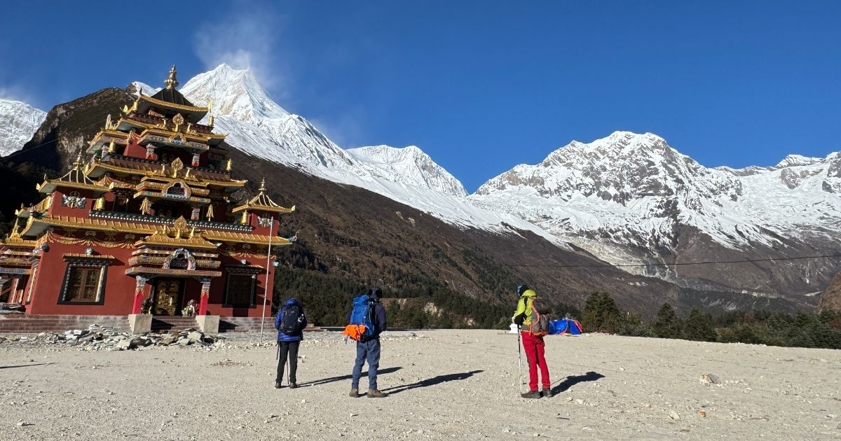
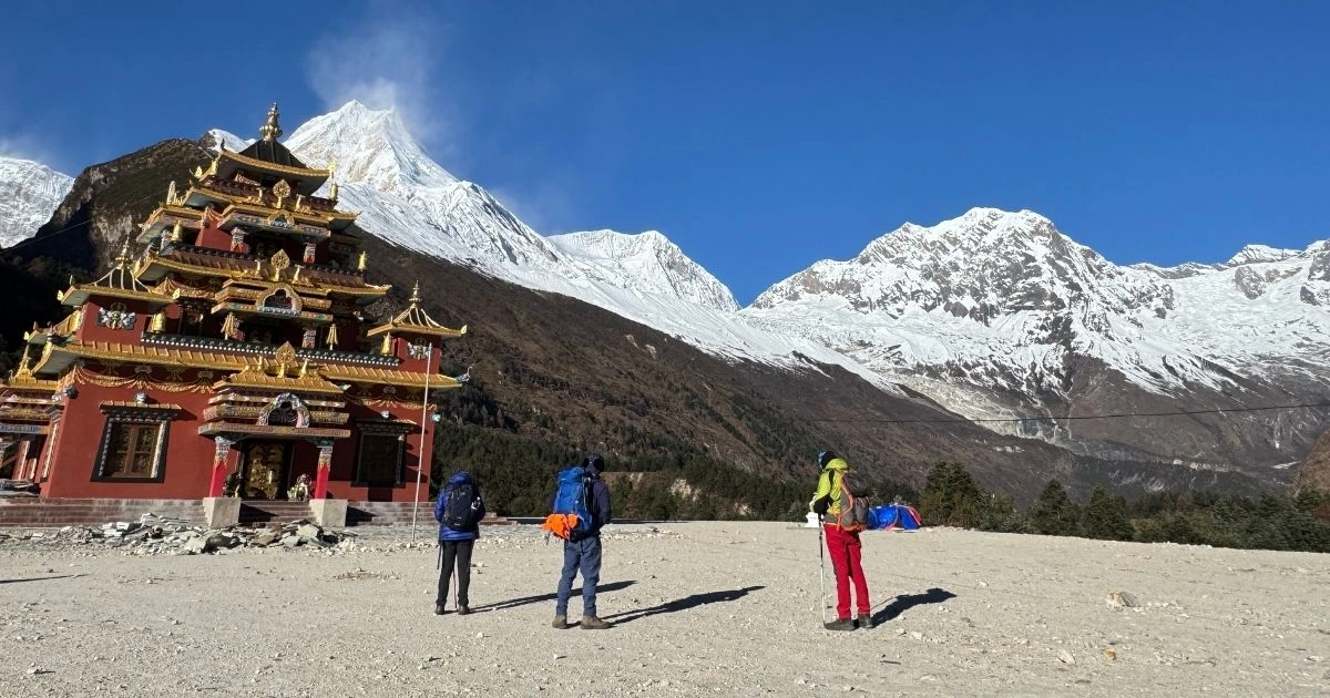
Tibetan Buddhist monastery

The region of Manaslu is home to centuries-old spiritual centers, including Mu Gompa and Rachen Gompa. You can walk through ancient halls filled with historic statues and ancient scrolls. Monks and nuns live in these remote compounds and maintain daily prayers. You will see Milarepa’s Cave, where the famous saint meditated. The walls of these structures hold centuries of history and offer a direct link to the region's spiritual past.

Experience the Traditional Tsumba Lifestyle and Local Communities

The local people belong to the Tsumba indigenous group. You will see how they manage livestock and grow hearty crops in the rocky soil. Their daily routines rely on ancient agricultural methods and collective effort. Houses feature traditional stone masonry and flat roofs for drying grain. You can sit with families in their kitchens to learn about survival at high altitude.

Participate in Local Festivals, Ceremonies, and Spiritual Celebrations

Festivals like Lhosar and Saga Dawa bring the entire community together. You can watch mask dances that tell ancient religious stories. Locals dress in their finest wool garments and heavy turquoise jewelry. The air fills with the smell of incense and the sound of long horns. You will witness community prayers that focus on global peace and the well-being of all living things.

Learn About the Valley's Centuries-Old Tibetan Heritage

The Tsumba dialect shares deep linguistic roots with Tibetan culture. You can trace this influence through the architecture, clothing, and religious art. Large stone chortens and long mani walls mark the entrance to every village. Local families preserve historical scrolls and family lineages that date back to the Tibetan empire. You will understand how these border communities have preserved their heritage over the centuries.

Witness Ancient Customs and Unique Social Traditions

The region still practices polyandry to keep family land intact. You will learn how this marriage system helps families survive in a harsh climate with limited resources. The valley also operates under a strict code called Shagya. This traditional law bans the slaughter of animals and the burning of forests. You will see a society that prioritizes collective harmony over individual gain.

Visit Villages Where Ancient Himalayan Traditions Still Thrive

Villages like Chhekampar and Nile feel frozen in time. You will walk through narrow stone alleys where yaks haul firewood. Modern technology remains rare, so locals rely on traditional blacksmithing and hand-weaving. Elders still guide the community using customary laws. You will see a self-sufficient way of life that values nature, heritage, and mutual support.

Why Combine Tsum Valley with the Manaslu Circuit Trek?

Combining these two routes turns a classic mountain trek into a complete Himalayan adventure. The standard Manaslu Circuit is famous for its rugged alpine terrain and high-altitude challenges. But adding the Tsum Valley introduces you to a sacred, hidden pocket of ancient Tibetan Buddhist culture. You get to explore centuries-old monasteries and experience a traditional way of life that remains untouched by modern tourism. This extension allows you to maximize your restricted-area permits and see two distinct valleys in one journey, extending your trek to 17 or 18 days.
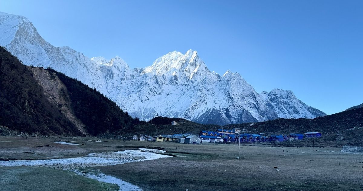
Bhimthang

Also, this joint itinerary serves as an excellent natural way to acclimate your body. The gradual ascents inside the Tsum Valley help you adapt safely to higher elevations over several days. You sleep at manageable altitudes up to 3,700 m before you tackle the main circuit's highest points. Meanwhile, this extra walking time builds your physical stamina and strengthens your legs. This preparation ensures you are fully ready to conquer the grueling Larkya La Pass at 5,106 m.

What Is the Weather Like on the Manaslu Circuit Tsum Valley Trek Throughout the Year?

The Manaslu Circuit Tsum Valley Trek covers a wide altitude range, from 700 m to 5,160 m at Larkya La Pass. This means you will experience everything from subtropical heat to freezing arctic zones in a single journey. Weather dictates your safety, trail conditions, and visibility on this remote route. You must understand the seasonal shifts before booking your trip to ensure the high passes are open and safe.

Month-by-Month Weather and Trail Conditions

MonthAverage Temperature (Lower Regions)Average Temperature (Above 4,000 m)Trail Conditions and Visibility
January8°C (46°F) to 18°C (64°F)-15°C (5°F) to -8°C (18°F)Heavy snow. Larkya La Pass is often closed. High landslide risk from ice.
February10°C (50°F) to 20°C (68°F)-13°C (9°F) to -5°C (23°F)Deep snow remains. Freezing winds. Only for elite winter trekkers.
March12°C (54°F) to 23°C (73°F)-10°C (14°F) to 0°C (32°F)Winter snow begins to melt. Clear mornings with lingering ice patches.
April15°C (59°F) to 25°C (77°F)-5°C (23°F) to 8°C (46°F)Firm trails. High visibility. Rhododendrons bloom across Tsum Valley.
May20°C (68°F) to 31°C (88°F)0°C (32°F) to 10°C (50°F)Warmest trekking days. High humidity builds afternoon haze.
June20°C (68°F) to 30°C (86°F)2°C (36°F) to 12°C (54°F)Monsoon begins. Slippery mud, frequent leeches, and cloud cover.
July22°C (72°F) to 32°C (90°F)3°C (37°F) to 12°C (54°F)Peak monsoon rain. High landslide risk. Rivers flood trail sections.
August20°C (68°F) to 30°C (86°F)3°C (37°F) to 12°C (54°F)Heavy rain continues. Trails are wet. Rain tapers off late in the month.
September15°C (59°F) to 22°C (72°F)-5°C (23°F) to 7°C (45°F)Transition month. Early rain gives way to crisp, dry autumn air.
October10°C (50°F) to 20°C (68°F)-12°C (10°F) to 5°C (41°F)Sharpest mountain views. Dry, stable trails. Peak trekking crowd.
November5°C (41°F) to 15°C (59°F)-8°C (18°F) to 0°C (32°F)Freezing night temperatures. Bright, sunny days. Thinner crowds.
December8°C (46°F) to 12°C (54°F)-20°C (-4°F) to -6°C (21°F)Winter sets in. High teahouses close. Clear skies but extreme cold.

What is the best time to do the Manaslu Circuit Tsum Valley trek?

Spring and Autumn are the two best seasons to do the Manaslu Circuit Tsum Valley Trek. Spring, from March to May, is an excellent window for this long route. The winter snow finishes melting by April, which leaves the trail to Larkya La Pass dry and navigable. You will experience mild daytime temperatures in the lower valleys, though high elevations still drop below freezing at night. Forested sections below Mu Gompa fill with blooming rhododendrons during this time. But afternoon clouds are common, meaning you should complete your high-altitude hiking before noon to secure the breathtaking views of Manaslu Tsum Valley.
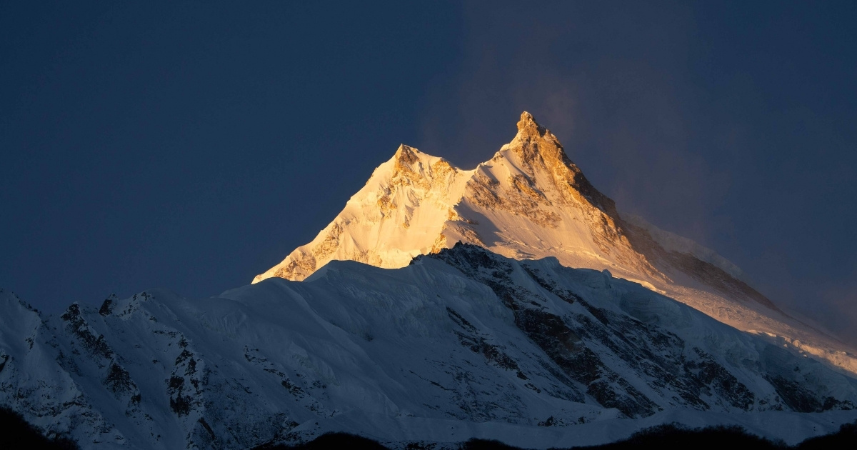
sunrise at manaslu

Autumn spans from September to November and stands as the absolute peak season to witness the beauty of the Manaslu region. By October, the monsoon rains completely wash the dust from the air, resulting in unmatched atmospheric clarity. You will find the most consistent weather patterns, lowest rainfall risks, and safest trail conditions of the entire year. Daytime temperatures remain cool and comfortable for strenuous climbing, though November brings severe night freezes. Because conditions are so reliable, teahouses fill up quickly, making early booking crucial.

What Permits Are Required for the Manaslu Circuit Tsum Valley Trek?

You need four specific permits to legalize your journey through this combined route in 2026. These are the Manaslu Restricted Area Permit (RAP), the Tsum Valley Restricted Area Permit, the Manaslu Conservation Area Permit (MCAP), and the Annapurna Conservation Area Permit (ACAP). The separate local Chumnubri Rural Municipality fee is also mandatory. You must secure all of these documents through a registered Nepalese trekking agency before leaving Kathmandu. Government checkpoints along the trail will verify your paperwork daily.

Why Do You Need Special Permits for This Trek?

The government restricts access to these valleys due to their proximity to the international border with Tibet. These permits help authorities manage foreign national movements and maintain regional security. Also, the strict quota system prevents overtourism in fragile ecosystems. Meanwhile, the fee revenue directly funds local environmental protection and preserves the ancient Tibetan Buddhist heritage of the local communities. Likewise, the paperwork ensures that every trekker employs a licensed professional for safety.

Can You Trek the Manaslu Circuit Tsum Valley Without a Guide?

You cannot trek this route without a professional guide under any circumstances. Nepal's Department of Immigration regulations prohibit independent trekking in these restricted zones. But a recent 2026 regulation update allows a single foreign traveler to obtain the required restricted-area permits. This means you can now solo trek without joining a larger group of tourists. However, you must still hire a mandatory government-licensed guide and book your logistics through a registered agency.

Real Challenges You May Face on the Manaslu Circuit Tsum Valley Trek

You must prepare for severe altitude exposure, unpredictable mountain weather, and grueling trail conditions throughout the trek. While the landscapes are immense, the isolation means there are no medical facilities for most of the route. But the physical strain of back-to-back walking days presents the largest hurdle. Also, you will navigate narrow, rocky paths prone to landslides, especially in the lower gorges, before entering the Manaslu alpine zones. Meanwhile, basic teahouse infrastructure within the Manaslu conservation area requires you to compromise on luxuries like stable Wi-Fi and heated rooms. Likewise, the sheer length of the combined route introduces deep cumulative fatigue.
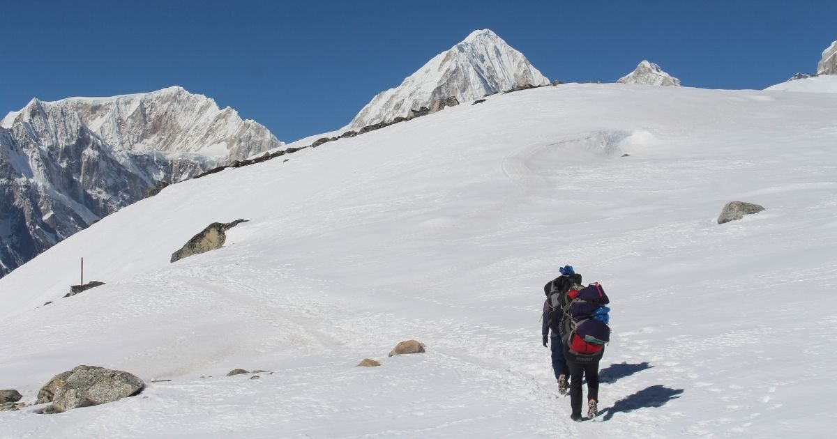
descending from Larkya top

The threat of Acute Mountain Sickness (AMS) increases dramatically as you cross into the high-altitude zones of Mu Gompa and Samagaon. Your body requires time to adjust to the thin air, but tight itineraries often tempt trekkers to push too fast. Like Manaslu itself, the Tsum Valley region demands immense respect for local weather, which can dump sudden snow on high passes. But physical exhaustion remains your daily opponent on the steep, stone staircases. Also, gastrointestinal issues from dietary changes can quickly drain your energy. Staying healthy requires strict hydration, careful food choices, and constant communication with your licensed guide.

How Difficult is the Larkya La Pass Crossing?

The Larkya La Pass crossing is the hardest part of the trek because you must ascend to 5,160 m in freezing, pre-dawn temperatures. Your day begins around 3:00 AM from Dharmasala to avoid the high winds that lash the summit after midday. You will battle thin air and a steep 700 m elevation gain over rugged, icy moraines. But the physical demand does not end at the top. The descent into Bhimtang is notoriously steep, slick with ice, and brutal on your knees. Completing the trek safely across this pass requires crampons during late autumn or spring, immense leg endurance, and steady pacing to counter the extreme exhaustion.

Is the Manaslu Circuit Tsum Valley Trek Safe for Female Travelers?

The Tsum Valley trek is one of the safest and most culturally enriching journeys in Nepal for female travelers. Local Buddhist communities along the route practice deep non-violence and hold deep respect for all visitors, meaning harassment or theft is virtually unheard of. But the remote terrain demands proper preparation, and you cannot walk completely alone. Nepal’s Department of Immigration requires all foreign travelers to hire a licensed trekking guide through a registered agency. Fortunately, under the current 2026 regulations, solo female travelers can obtain their Restricted Area Permits individually without needing to find a second trekker. Your mandatory guide handles route navigation, tracks unpredictable weather shifts, and monitors you for altitude sickness. Also, staying in established family-run teahouses provides a secure, warm environment at the end of every walking day.

Common Mistakes Trekkers Make on the Manaslu Circuit Tsum Valley Trek

You must avoid these common mistakes to ensure your safety and success on the trail:

  • Skipping acclimatization days: Rushing through the high-altitude sections of Tsum Valley or Samagaun dramatically increases your risk of Acute Mountain Sickness (AMS).
  • Packing improper footwear: Wearing unbroken-in boots or failing to pack crampons for the icy Larkya La Pass leads to severe blisters and dangerous slips.
  • Underestimating daily hydration: Failing to drink 4 to 5 liters of water daily accelerates fatigue and slows down your body's natural adaptation to thin air.
  • Ignoring minor symptoms: Concealing headaches, nausea, or mild coughs from your licensed guide can cause preventable medical evacuations.
  • Mismanaging electronics: Forgetting extra power banks or failing to keep your batteries warm inside your sleeping bag leaves you without communication devices.
  • Failing to carry enough local cash: Assuming you can use credit cards or ATMs past the lower trailheads will leave you unable to pay for basic services.

What Happens During Acclimatization Days?

Your acclimatization days are active rest periods designed to trigger red blood cell production without exhausting your physical reserves. You will follow the classic mountaineering rule of walking high and sleeping low to prepare your body for the thin alpine air. In places like Samagaun, we take you on mandatory acclimatization hikes to Birendra Tal or the rugged ridges near the lower Gandaki valley. But these days are not meant for lounging around the teahouse all afternoon. Also, actively moving your limbs helps prevent muscle stiffness from previous long walking days. Meanwhile, your licensed guide utilizes this downtime to monitor your oxygen saturation levels and evaluate your readiness for the high pass crossing.

Manaslu Circuit Tsum Valley Trek Budget Management

Proper budget management requires you to look beyond the upfront booking costs and account for personal on-trial expenditures. Your base trip cost generally covers your mandatory licensed guide, porter logistics, restricted area permits, and three standard meals per day. But the standard trek offers usually exclude personal amenities, which quickly add up to a high extra cost. You must budget separately for hot showers, device charging fees, Wi-Fi access, bottled drinking water, and alcoholic beverages at the higher elevations. Also, remember that our standard trek includes everything from the trailhead onwards, but you must secure your own Kathmandu hotel accommodation and personal travel insurance independently.

Why Choose the Manaslu Circuit Tsum Valley Trek with Nature Excursion

Choosing Nature Excursion ensures you navigate this remote borderland with a highly trained, elite team of local experts. Our field guides have spent years leading expeditions through the rugged part of the Manaslu region, meaning they know every alternative path, weather pattern, and local teahouse owner. But we prioritize your physical safety above all else. Our guides carry pulse oximeters and comprehensive medical kits to monitor your health daily. Also, we maintain a strict porter-to-trekker ratio to guarantee that your heavy gear is transported safely and ethically.
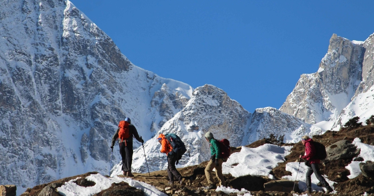
way to manaslu

We design our itineraries with realistic walking times and dedicated acclimatization windows to maximize your summit success rate at the Larkya La Pass. We do not cut corners by rushing your ascent. Our deep relationships with the indigenous Tsumba and Gurung communities allow you to experience authentic Buddhist hospitality without feeling like a regular tourist. But our service extends far beyond route navigation. We handle all the tedious, bureaucratic permit paperwork in Kathmandu before you arrive, so you can focus entirely on your physical preparation.

Manaslu Circuit Tsum Valley Trek – 19 Days FAQs

  • Q1. How difficult is the Manaslu Circuit Tsum valley trek?

    The Manaslu Circuit Tsum Valley trek is a challenging trek. It involves a diverse terrain, including steep ascents and descents, river crossings, and high mountain passes.

  • Q2. How long is the Manaslu Circuit Tsum valley trek?

    The Manaslu Circuit Tsum Valley trek typically takes around 18 to 21 days to complete. The standard route covers approximately 177 kilometers (110 miles) and includes both the Manaslu Circuit and the Tsum Valley.

  • Q3. Is the Manaslu Circuit Tsum Valley trek safe?

    The safety of the Manaslu Circuit Tsum Valley trek largely depends on various factors, including weather conditions, your level of preparation, and adherence to local regulations. Generally, the trek is safe when approached with caution and proper planning.

  • Q4. Is trekking to Tsum Valley worth it?

    Tsum Valley is a culturally distinct region of Nepal inhabited by ethnic Tibetan communities. Compared to some of Nepal's more popular trekking regions, such as the Everest and Annapurna regions, Tsum Valley sees fewer trekkers. This means you can enjoy a quieter and more serene trekking experience. Likewise, the landscape in Tsum Valley is stunning, with lush green valleys, pristine rivers, and panoramic views of the Himalayan peaks.

  • Q5. Why is Mu Gompa famous?

    Mu Gompa is a Tibetan Buddhist monastery located in the remote Tsum Valley region of Nepal. It is situated in a remote and pristine valley that has remained relatively untouched by modern development. Mu Gompa serves as an important place of worship and learning for monks and pilgrims in the Manaslu region.

  • Q6. Can I do the Manaslu Tsum Valley Trek without a guide?

    No, you cannot complete the Manaslu Tsum Valley Trek without a guide, as it passes through a strictly regulated area. While 2026 rules allow you to trek solo without a second traveler, you are legally mandated to hire a licensed, government-registered guide through an authorized agency to clear the checkpoints.

  • Q7. Which trek is tougher, the Manaslu Tsum Valley or the Everest Base Camp Trek?

    The Manaslu Tsum Valley Trek is tougher due to its longer duration, higher pass altitude, and rugged, less-developed trails. While the Everest Base Camp Trek has well-established paths and abundant modern amenities, the Tsum Valley demands greater physical endurance due to its remote, primitive terrain.

  • Q8. What is the most common starting point of the Manaslu Tsum Valley Trek?

    The most common starting point for the Manaslu Tsum Valley Trek is Machha Khola, though many itineraries traditionally begin with a drive from Kathmandu to Soti Khola. Due to recent road expansions, most trekkers now skip the initial walking sections and start the trek directly from Machha Khola.

  • Q9. How do the acclimatization requirements differ between the Manaslu Tsum Valley and the Annapurna Base Camp Trek?

    The Manaslu Tsum Valley Trek involves a longer, more gradual acclimatization process because you spend multiple weeks ascending to the Larkya La Pass at 5,106 m. Conversely, the Annapurna Base Camp Trek requires less demanding acclimatization, as it maxes out at a much lower altitude of 4,130 m and can be completed safely in fewer days.

  • Q10. Can I trek just the Tsum Valley without the Manaslu Circuit?

    Yes, you can absolutely trek just the Tsum Valley without completing the full Manaslu Circuit. Your itinerary will branch off the main trail at Lokpa to explore the sacred valley and Mu Gompa before retracing your steps back down to Machha Khola.

  • Q11. How much does the Tsum Valley Permit cost?

    During peak Autumn (Sep–Nov), it costs USD 40 per person for the first week. In Spring/Winter (Dec–Aug), it drops to USD 30 per person for the first week. Extra days cost USD 7 per day year-round.

You may also like

Similar Packages