Quick Elevation Facts: Major Peaks of the Annapurna
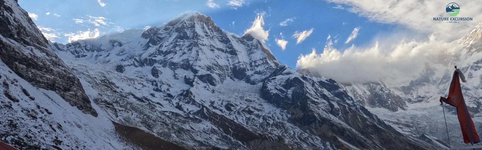
The Annapurna range is a 55 km-long series of peaks. While Annapurna I is the highest, the massif contains several other big summits:
| Mountain | Height (m) | Height (ft) |
| Annapurna I (Main) | 8,091 m | 26,545 ft |
| Annapurna II | 7,937 m | 26,040 ft |
| Annapurna III | 7,555 m | 24,787 ft |
| Annapurna IV | 7,525 m | 24,688 ft |
| Gangapurna | 7,455 m | 24,459 ft |
| Annapurna South | 7,219 m | 23,684 ft |
Explore the Annapurna Region
Want to experience the incredible landscapes around Annapurna? Explore our Annapurna trekking packages, routes, highlights, and essential trip details to plan your Himalayan adventure.
Three Annapurna Elevations Explained: Summit, Base Camp & the Massif
Annapurna I Summit
The Annapurna I summit is the highest point in the Annapurna massif. This point lies within the "death zone" where human life cannot last in the long term. Oxygen levels here are only about one-third of what they are at sea level.
Annapurna I is also known for its high avalanche risk. This is the point reached only by experienced mountaineers with advanced climbing skills, technical equipment, and climbing permits. It is completely different from the trekking routes visited by most travelers.
Annapurna Base Camp
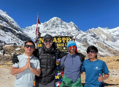
Annapurna Base Camp (4,130 m) is situated above the tree line in an alpine basin known as the Annapurna Sanctuary. At this elevation, atmospheric pressure drops, meaning each breath contains only about 60% of the oxygen.

Unlike the summit of Annapurna I, ABC is a trekking destination that does not need technical climbing equipment or mountaineering experience. Most healthy trekkers can reach the base camp with proper acclimatization and adequate preparation.
The Annapurna Massif
The Annapurna massif is a large mountain system rather than a single peak. It spreads about 55 km across north-central Nepal and extends from around 6,000 m to the 8,091 m summit of Annapurna I. The massif covers several mountains above 7,000 m, such asAnnapurna II (7,937 m), Annapurna III (7,555 m), and Gangapurna (7,455 m).
The massif also acts as a natural climate barrier. It forces moisture from the summer monsoon to fall on the southern areas, which support forests and biodiversity, while the northern side lies in a dry rain-shadow region that includes areas such as Upper Mustang.
How High Do Trekkers Actually Go in the Annapurna Region?
Most people who visit the Annapurna region never climb Annapurna I. Instead, they follow trekking routes that reach elevations between 3,210 m and 5,416 m. The highest point reached by most trekkers is Thorong La Pass (5,416 m) on the Annapurna Circuit Trek. Another popular destination is Annapurna Base Camp (4,130 m).

The maximum elevation depends on the trekking route you choose. Poon Hill reaches 3,210 m and is popular for short treks, while Manang sits at about 3,519 m and is an important acclimatization stop on the Annapurna Circuit. These elevations give trekkers a chance to enjoy the high mountains of the Annapurna range without reaching the summit of Annapurna I.
Which Annapurna Trek Matches Your Fitness Level?
The table below outlines standard guided packages in Annapurna for 2026.
| Package | Days | Difficulty | Cost | Best For |
| Annapurna Base Camp Trek | 7-13 days | Easy to Moderate | USD 570-1,116 | Regular hikers wanting an all-around mountain experience |
| Annapurna Circuit Trek | 9-15 days | Strenuous | USD 650-1,193 | Fit trekkers looking to explore diverse landforms |
| Ghorepani Poon Hill Trek | 4-9 days | Easy to Moderate | USD 299-745 | Beginners, families, and those short on time |
| Annapurna Circuit With Tilicho Lake Trek | 12-18 days | Strenuous | USD 752-1,285 | Highly fit adventurers aiming for one of the world's highest lakes |
| Nar Phu Valley Trek | 9-15 days | Moderate to Strenuous | USD 834-1,572 | Fit hikers, culture enthusiasts, photographers, and nature lovers |
| Mardi Himal Trek | 5-14 days | Moderate | USD 399-1,237 | Photographers seeking uncrowded ridge views |
| Khopra Danda Trek | 8-12 days | Moderate | USD 583-1,120 | Beginner to intermediate trekkers looking for analternative to the Poon Hill route. |
Can Beginners Trek to Annapurna Despite Its Height?

Yes, beginners can trek in the Annapurna region because the popular trekking routes are very different from climbing the 8,091 m Annapurna I summit. Trails such as the Annapurna Base Camp Trek and many areas of the Annapurna Circuit follow developed trails, stone staircases, and suspension bridges. Most routes are supported by teahouses that provide meals, accommodation, and services, so there is no need to carry camping equipment. Beginners do not need ropes, ice axes, or technical climbing skills.
Annapurna I: History and Records
Annapurna I has written its name in the history of Himalayan climbing through achievements and difficult expeditions. Let's look at some of its history and records.
- The First 8,000er Ever Climbed (1950): On June 3, 1950, French climbers Maurice Herzog and Louis Lachenal made history by reaching the summit of Annapurna I.
- The Cost of Victory: Severe frostbite during the descent caused both climbers to lose toes, while Herzog also lost most of his fingers after emergency medical treatment.
- The South Face Summit (1970): British climbers Don Whillans and Dougal Haston successfully climbed the vertical 3,000 m South Face for the first time.
- First Winter Ascent (1987): Polish climbers Jerzy Kukuczka and Artur Hajzer conquered the peak in winter conditions on February 3, 1987.
- Avalanche danger: The biggest hazard of Annapurna is sudden, catastrophic avalanches.
- Deadliest avalanche corridor: Most fatalities occur in an avalanche-prone chute at 5,900 m, between Camp II and Camp III on the North Face.
Why Is Annapurna Considered One of the World's Most Dangerous Mountains?
Annapurna I is considered one of the world's most dangerous mountains because of its extreme avalanche risk, technical topography, and highly unpredictable weather. Modern climbing statistics show that safety has improved, but the mountain still has an overall fatality rate of about 13.4%, with 75 recorded deaths and 559 successful summits. This is far lower than its historical rate of nearly 32%, yet it is much higher than Mount Everest, whose overall fatality rate is estimated at around 2.5%.
One of the most dangerous sections lies between Camp II and Camp III at around 5,900 m, where climbers must cross a large avalanche-prone area that has been responsible for many accidents. Above 8,000 m, climbers also enter the death zone, where the body receives only about one-third of the oxygen available at sea level and cannot maintain performance for long.
Plan Your Annapurna Adventure
Ready to explore the Annapurna region? Create a trekking plan that fits your available time, fitness level, preferred route, budget, and travel style.
Does Annapurna's Height Affect Trekkers?
Yes, Annapurna's high altitude affects trekkers, even though they never climb the 8,091 m summit. Popular routes such as the Annapurna Circuit reach Thorong La Pass at 5,416 m, while the Annapurna Base Camp Trek reaches 4,130 m. As oxygen levels decrease, the body works harder to supply muscles and organs with enough oxygen. This increases the risk of altitude-related illness.

The most common altitude problem is Acute Mountain Sickness (AMS), which develops above 2,500 m. In rare cases, AMS can develop into High Altitude Pulmonary Edema (HAPE), where fluid collects in the lungs and causes a persistent cough. Another rare but life-threatening condition is High Altitude Cerebral Edema (HACE), where fluid builds up in the brain and leads to confusion, poor balance, slurred speech, and changes in behavior.
Duration:7 DaysStart fromUSD 1050USD 890based on 21 reviews
What Every Trekker Must Know Before Going
Here is the essential checklist of everything you must know before you step onto the trail.
- Carry the Required Permits: Obtain the Annapurna Conservation Area Permit (ACAP) and any other permits required for your chosen route before starting your trek.
- Choose the Right Insurance: Buy travel insurance that covers trekking up to at least 6,000 m and includes emergency helicopter evacuation and medical treatment.
- Acclimatize Properly: Ascend slowly, drink plenty of water, and include rest or acclimatization days to reduce the risk of altitude sickness.
- Eat Safe and Stay Hydrated: Choose freshly prepared meals such as dal bhat, carry a reusable water bottle, and always purify drinking water before use.
- Carry Enough Cash: ATMs are unavailable on most trekking routes, and many teahouses accept cash only for meals, accommodation, charging devices, and hot showers.
- Prepare for Limited Electricity: Pack a high-capacity power bank, as charging facilities are limited and incur an extra fee at higher elevations.
AMS Risk: Symptoms and When to Turn Back
The risk of Acute Mountain Sickness (AMS) begins above 2,500 m. Early symptoms include a persistent headache, dizziness, loss of appetite, mild nausea, unusual tiredness, muscle weakness, and poor sleep. These signs should never be ignored.
If symptoms become worse or you develop severe breathlessness at rest, confusion, slurred speech, or difficulty walking in a straight line, you may have High Altitude Pulmonary Edema (HAPE) or High Altitude Cerebral Edema (HACE). These are life-threatening emergencies that need immediate descent and urgent medical care.
How to Acclimatize: Practical Steps That Work
- Walk at a speed where you can easily speak a full, 15-word sentence out loud without pausing to gasp for air.
- Do not sprint, run, or lift heavy objects.
- Do not immediately lie down in bed when you reach your afternoon teahouse.
- Monitor your hydration by keeping your urine clear.
- Eat heavy, carb-rich meals like Dal Bhat, porridge, or potatoes.
- Consume fresh garlic soup at the teahouses because it contains compounds that act as natural blood thinners.
How High Is Annapurna Compared to Other Famous Mountains?
To show just how tall Annapurna I is, here’s a comparison with some of the world’s most famous mountains, ranked by their height.
| Mountain | Country / Range | Elevation (m) | Height Relative to Annapurna I (8,091 m) |
| Mount Everest | Nepal / Tibet (Himalayas) | 8,848 m | 757 m higher |
| K2 | Pakistan / China (Karakoram) | 8,611 m | 520 m higher |
Aconcagua | Argentina (Andes) | 6,961 m | 1,130 m lower |
Denali | USA (Alaska Range) | 6,190 m | 1,901 m lower |
Kilimanjaro | Tanzania (Free-standing) | 5,895 m | 2,196 m lower |
| Mont Blanc | France / Italy (Alps) | 4,805 m | 3,286 m lower |
| Mount Fuji | Japan (Stratovolcano) | 3,776 m | 4,315 m lower |
Have Questions About Annapurna?
Wondering about Annapurna's altitude, trekking routes, weather, or the best time to visit? Talk to our trekking experts on WhatsApp for practical guidance before your trip.
Conclusion
Whether your goal is to reach Annapurna Base Camp or cross Thorong La Pass, proper planning is the key to a successful adventure. Choosing an experienced local trekking company such as Nature Excursion gives you access to customized itineraries, licensed guides, and reliable support throughout the journey. With the right preparation and expert guidance, you can explore the beauty of the Annapurna region more safely.
FAQs
How high is the vertical rock wall of Annapurna’s South Face?
Annapurna I South Face is about 3,000 m high from its base to the summit. It is one of the tallest and steepest rock walls in the world. Covered with ice and snow, it is famous for its difficult climbing routes and the danger of avalanches.
What elevation marks the start of the "Death Zone" on Annapurna I?
8,000 m is the altitude marking the entry into the death zone on Annapurna I. At this extreme height, the human body can no longer adapt to the atmosphere.
How high is Machhapuchhre Base Camp relative to Annapurna Base Camp?
3,700 m is the elevation of Machhapuchhre Base Camp (MBC), sitting exactly 430 m lower than Annapurna Base Camp (4,130 m). Trekkers stop at this high-altitude valley overnight before making their final push into the core Sanctuary.
How high is the pass connecting the Annapurna and Manaslu regions?
Larkya La Pass is 5,160 m above sea level. It connects the Annapurna and Manaslu regions and is one of the highest trekking passes in Nepal. Although it is not part of the standard Annapurna Circuit, its high altitude is similar to that of Thorong La Pass.
At what altitude does tree line vegetation disappear in the Annapurna range?
4,000 m is the approximate elevation where the subalpine birch and rhododendron forests give way to alpine shrubs.


.webp)