Quick Comparison of the Viewpoints in Langtang Region
| Viewpoint | Altitude | Difficulty | Hiking Time | Best For |
| Kyanjin Ri | 4,773 m | Moderate | 2–3 hrs from Kyanjin Gompa | Sunrise views, glaciers, and mountain scenery |
| Tserko Ri | 5,033 m | Challenging | 4–5 hrs from Kyanjin | The highest accessible viewpoint in Langtang Valley |
| Langshisha Ri | 6,427 m | Very Difficult | Multi-day expedition | Experienced climbers looking for remote Himalayan views |
| Ganja La Pass | 5,122 m | Very Challenging | 7–9 hrs crossing day | High mountain pass views, glaciers, and adventure trekking |
| Kyanjin Gompa Ridge | 3,870–4,100 m | Easy | 30–60 min from Kyanjin | Short acclimatization hike and sunset photography |
| Lauribina Pass | 4,610 m | Challenging | 6–8 hrs from Gosaikunda | Views of Langtang, Ganesh Himal, Gosaikunda Lake and Annapurna ranges |
| Thulo Syabru Viewpoint | 2,230 m | Easy | 15–30 min from the village | Lower-elevation views of Langtang Himal and Tamang villages |
| Sing Gompa | 3,330 m | Moderate | 1–2 hrs around the area | Explore oak and rhododendron forests and Sing Gompa Monastery |
| Gosaikunda Lake | 4,380 m | Moderate | 5–7 hrs from Sing Gompa | Alpine lake scenery and Himalayan peaks |
Plan Your Langtang Trek
Ready to follow the map and start trekking? Talk to our team for route advice, trek details, availability, and help planning your Langtang adventure.
Kyanjin Ri
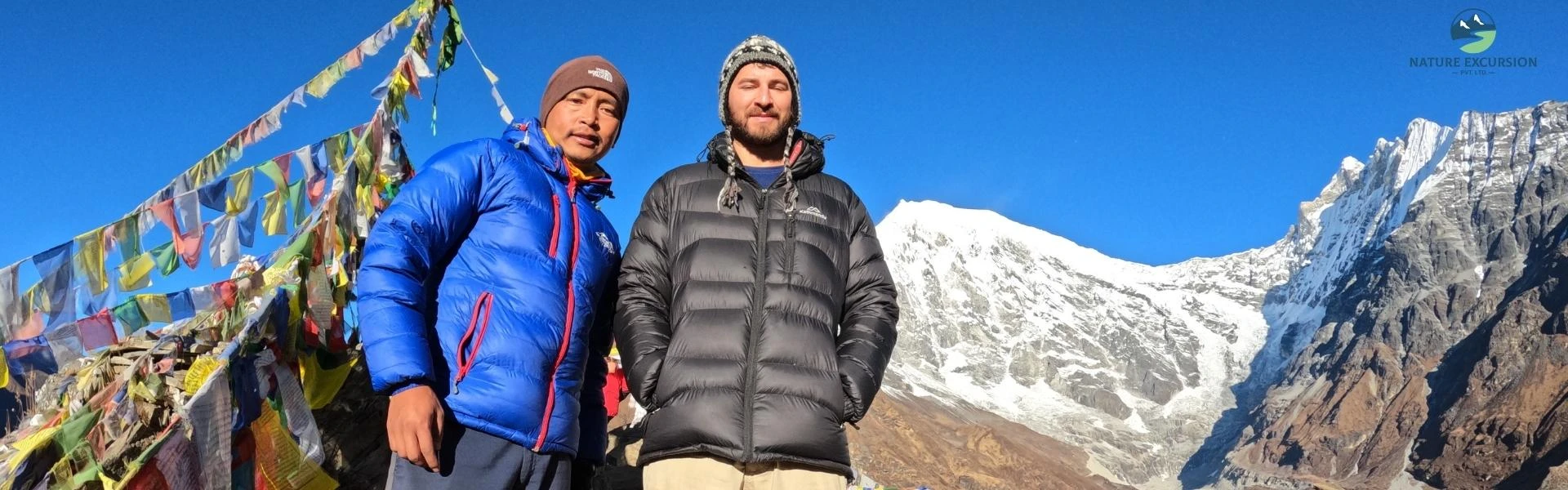
It has two main summits: Lower Kyanjin Ri (4,300 m) and Upper Kyanjin Ri (4,773 m). Most trekkers reach the lower summit in 2–3 hours before hiking for about another hour to reach the upper summit. Once you are on top of either peak, you can enjoy one of the finest views in the Langtang region. The south face of Langtang Lirung, Kimshung Peak (6,781 m), Yansa Tsenji Peak (6,567 m), and Dorje Lakpa (6,966 m) are the major attractions.
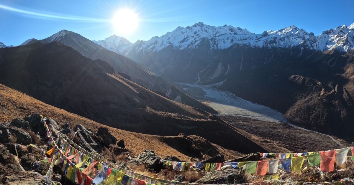
The viewpoint also overlooks Kyanjin Gompa, the Langtang River, glaciers, and the old airport runway. Do not attempt Kyanjin Ri on the afternoon you arrive from Langtang Village. Sleep at Kyanjin Gompa (3,830 m) for at least one night first to reduce the risk of Acute Mountain Sickness (AMS) before attempting it.
Tserko Ri
Tserko Ri (also spelled Tsergo Ri) is the high-altitude vantage point of the Langtang Valley trek located 1,100 m above Kyanjin Gompa. It takes around 7 to 9 hours for a complete round trip. From the summit, trekkers can see Langtang Lirung, Kimshung (6,781 m), Dorje Lakpa, Naya Kanga (5,844 m), Langshisa Ri (6,427 m), and several small peaks in the Nepal–Tibet border.
Even Shishapangma (8,027 m), the only 8,000-m peak located in Tibet, can be visible on clear days. The viewpoint also overlooks the Yala Glacier and the upper Langtang glacier zones. Trekkers should hit the trail by 5:00 AM because clouds roll into the upper valley by noon, which can obscure the views and affect the navigation all the way to the summit.
Langshisha Ri
Langshisha Ri is a razor-sharp peak situated in the upper eastern part of the Langtang Valley. The journey to the top is done as a long day hike or an overnight camping side trip from Kyanjin Gompa. From Langshisha Ri viewpoint, trekkers can witness Langshisha Ri (6,427 m), Dorje Lakpa (6,966 m), Urkinmang, and several unnamed 6,000-m peaks.
The view extends beyond mountains to include the Langshisha Glacier, Shalbachum Glacier, and the wider upper Langtang glacial system. This peak is classified as an advanced Group A trekking peak by the Nepal Mountaineering Association (NMA). So if you're thinking of climbing it, you need proper preparation, technical climbing skills, and the equipment required for a peak expedition.
Ganja La Pass
Ganja La Pass (5,122 m) is the highest trekking pass in the Langtang region. It connects the Langtang Valley with the Helambu region. Unlike Kyanjin Ri or Tserko Ri, this route is completed as part of a multi-day crossing rather than a day hike. Most trekking groups spend a night at Ngegang Kharka (4,400 m) before crossing the pass. There are no teahouses between Kyanjin Gompa and Keldang, so trekkers must camp and carry additional equipment for the journey.
The view from the pass spreads over two distinct Himalayan regions. To the north, trekkers can see Langtang Lirung, Kimshung, Langtang Glacier, and much of the upper Langtang Valley. To the south, the view opens toward the forested hills and valleys of Helambu. Naya Kanga, also known as Ganja La Chuli (5,844 m), is also seen directly in front of the pass.
Plan an Langtang Trip That Fits You
Want more flexibility? Adjust your Langtang itinerary, trekking days, stops, and activities to match your travel preferences.
Kyanjin Gompa Ridge
Kyanjin Gompa Ridge is a short viewpoint located directly above Kyanjin Gompa at 3,830 m. The trail onto the ridge begins right past the Kyanjin Gompa monastery. The ridge provides a clear view of Kyanjin Gompa, the Langtang Khola, yak pastures, and the upper Langtang Valley. Trekkers can also see Naya Kanga, Langtang Lirung, Gangchenpo, and the route leading toward Ganja La Pass.
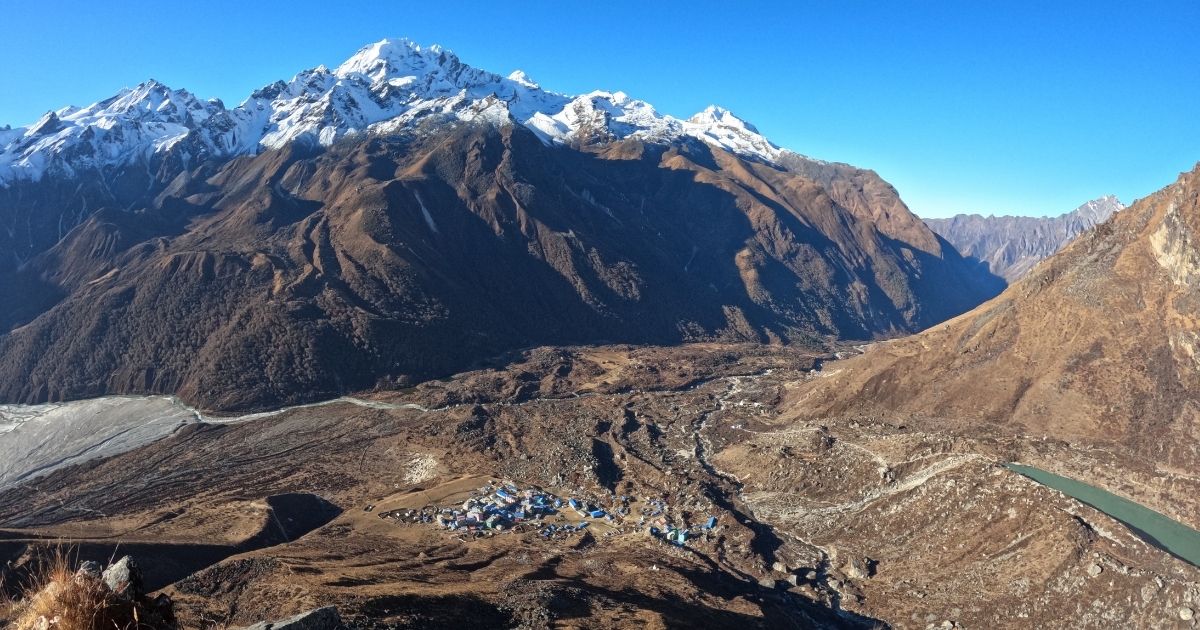
Because the ridge line extends all the way to 4,773 m, it is the best tool for "climbing high and sleeping low". If you feel the effects of the altitude at 4,200 m, you can simply stop, enjoy the view, and descend safely back to your tea house within 30 minutes. The absolute best time to ascend the ridge is at 5:00 AM to watch the sunrise over Langtang Lirung.
Lauribina Pass
Lauribina Pass, also known as Lauribina La (4,610 m), is the highest point between the Gosaikunda Lake area and the Helambu region. The pass is the main highlight of the Langtang–Gosaikunda trek and offers some of the best mountain views in Langtang National Park. Trekkers can reach the pass within 6 to 8 hours after a climb of about 230 m from Gosaikunda.
The viewpoint is known for mountain scenery and high-altitude lakes. Looking north, trekkers can see Gosaikunda, Bhairav Kunda, and Saraswati Kunda. To the west are Ganesh Himal (7,422 m), Manaslu (8,163 m), and Himalchuli (7,893 m), and other peaks of the Mansiri Himal range. The turquoise lakes below and the mountains on the horizon make Lauribina Pass one of the most scenic viewpoints in the entire Langtang region.
Thulo Syabru Viewpoint
Thulo Syabru Viewpoint (also referred to as the Thulo Syabru Ridge) is an underrated viewpoint located just above the Bhote Koshi and Langtang Valley. Trekkers reach it either by diverting from Bamboo or Pairo when descending the main valley, or by completing a multi-hour climb up from Syabrubesi.
From this viewpoint, you can see Langtang Lirung in the north, the Ganesh Himal range and Manaslu massif to the west, and the beautiful river systems far below that resemble a snake. You can also see the vertical staircase that takes climbers toward Dursagang and the Sing Gompa Cheese Factory (3,330 m).
Sing Gompa
Sing Gompa, also known as Chandan Bari, is a religious mountain settlement located at 3,330 m on the route to Gosaikunda Lake. It is an important overnight stop for trekkers traveling between Thulo Syabru and the higher alpine zone. The area is surrounded by pine, fir, and rhododendron forests that form part of Langtang National Park.
From the ridge near the Sing monastery, trekkers can capture Langtang Lirung and several peaks of the Ganesh Himal range to the west, including Ganesh I (7,422 m). Sing Gompa is famous for one of the oldest traditional Swiss-designed yak cheese factories in Nepal. Trekkers can tour it and sample fresh, alpine cheese straight from the cooling shelves.
Gosaikunda Lake
Gosaikunda Lake is more than just a destination; it's a place of spiritual meaning and natural wonder. Tucked high in the Himalayas at an elevation of about 4,380 meters, this sacred alpine lake is a highlight for anyone seeking the best viewpoints during the Langtang Valley Trek.
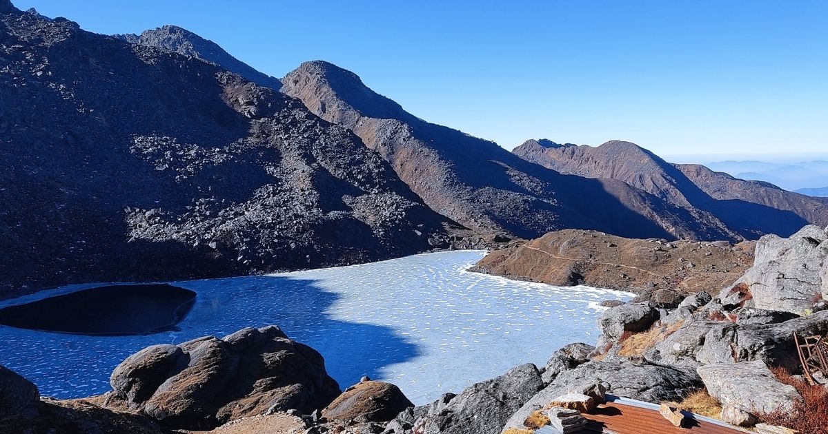
The stretched view of Surya Peak (5,145 m) on the horizon is mesmerizing. During the full moon festival in August, the viewpoint transforms into a cultural hub. Thousands of Hindu pilgrims and local shamans (Dhami/Jhankris) trek to the lake to take a holy bath in the freezing waters and change their inner souls.
Best Time to Visit Langtang Valley Viewpoints
The best time to visit the viewpoints in the Langtang region is during the Autumn (October to November) and Spring (March to May) seasons. The table below breaks down the viewing conditions, trail safety, and visual highlights across all four seasons.
| Season | Viewpoint Visibility | Trail Conditions & Safety | Visual Highlights |
| Autumn (October-November) | Very clear (95%) | Very safe with dry trails and clear navigation markers | Cloudless skies, golden sunrise reflections on Langtang Lirung |
| Spring (March-May) | Good (80%) | Moderate, High passes (Lauribina, Ganja La) may hold melting snow. | Pink/red rhododendron forests below 3,330 m (Sing Gompa) |
| Winter (December -February) | Clear but Brief (70%) | Hazardous, Extreme cold, high peaks blocked by snow. | Frozen Gosaikunda lake, arctic topography |
| Monsoon (June-September) | Poor (15%) | Dangerous, slippery mud, landslide areas, and leeches | Green terraced fields, strong waterfalls. |
When Is the Best Time for Langtang?
Not sure when to follow the Langtang route? Check the best seasons, weather, trail conditions, and mountain views before planning your trek.
Which is the Best Viewpoint in Langtang Valley?
If only one viewpoint can be chosen, Tserko Ri is the best viewpoint in the Langtang region. It stands higher than Kyanjin Ri, offers a wider field of view than Kyanjin Gompa Ridge, and is accessible to ordinary trekkers, unlike Langshisha Ri and Ganja La Pass, which need mountaineering or expedition-style trekking.
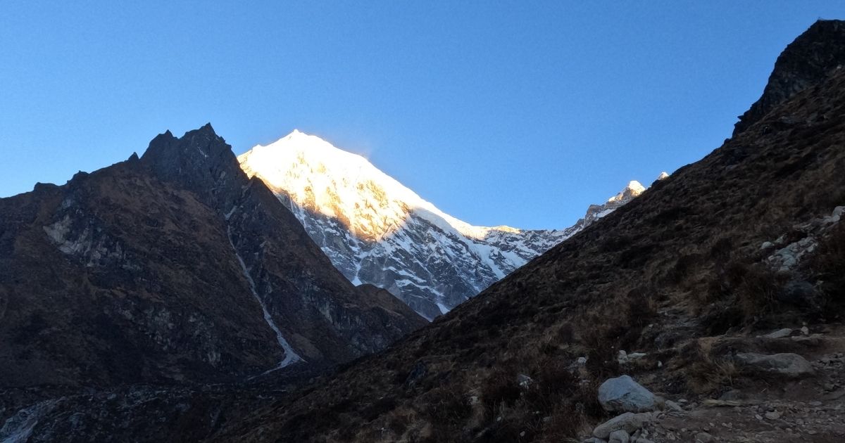
That said, the best viewpoint depends on what you want to experience. Kyanjin Ri is the best balance of effort. Langshisha Ri provides the most beautiful valley scenery. Ganja La Pass offers the most adventurous crossing. Lauribina Pass combines mountain views with high-altitude lakes. Gosaikunda Lake is the most culturally important lookout point. Thulo Syabru and Sing Gompa provide lower-altitude panoramas, while Kyanjin Gompa Ridge is best for short acclimatization hikes.
Tips for Hiking to Langtang Valley Viewpoints
The most important safety and preparation tips for reaching these high-altitude viewpoints are explained below:
- Spend at least one acclimatization day at Kyanjin Gompa before hiking to Kyanjin Ri, Tserko Ri, or other high viewpoints.
- Use Kyanjin Gompa Ridge for a short acclimatization hike and return to the village to sleep.
- Drink 4–5 liters of water per day because the dry mountain air increases fluid loss.
- Start major hikes between 4:30 AM and 5:00 AM during calmer weather.
- Set a turnaround time and head back if weather conditions worsen or progress becomes too slow.
- Pack warm layers, gloves, and a windproof jacket because summit temperatures can be much colder than in the villages.
- Bring enough snacks, water, and a packed lunch since there are no teahouses on many viewpoint trails.
- Keep phones, cameras, and spare batteries inside your jacket because cold temperatures can drain battery power quickly.
Have Questions About Your Trek?
Get quick answers about routes, costs, permits, difficulty, or travel dates from our trekking team before you book.
Conclusion
The Langtang region offers a variety of viewpoints that range from 2,230 m to high Himalayan summits above 5,000 m. Kyanjin Ri and Tserko Ri provide the most famous mountain views, while Langshisha Ri, Ganja La Pass, and Lauribina Pass showcase remote geography, glaciers, and dry Himalayan landscapes.
If you have time for only one viewpoint, Tserko Ri stands out as the most complete mountain viewpoint in the region. However, each location offers something unique. Some are known for glaciers and peaks, while others are famous for lakes, cultures, and traditions. Choose the viewpoints that best match your interests and enjoy the beauty of Langtang.