Where are Chame and Upper Pisang Located?
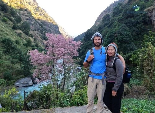
Chame is located in the Manang District of northern Nepal, at an elevation of 2,670 m. It is tucked into a narrow valley where the sound of the Marshyangdi River runs quite loudly. Chame is among the earliest important stops on the Annapurna Circuit Trek. For me, it is the first place that genuinely felt as if the mountains had closed around. I visited the thick pine forests and apple orchards that locals have tended for generations. During peak seasons like Spring, the smell of wood smoke and ripe fruit fills the air.

On the other hand, Upper Pisang is located further up the trail at an elevation of 3,300 m. It sits on a steep hillside directly across from the massive rock face of Paungda Danda. While Lower Pisang sits on the valley floor, the Upper Pisang village offers a much better vantage point. I realized that the extra climb to the upper village is worth it because the views of Annapurna II are much clearer from there, and I could click some amazing photos. The village is home to the ancient Nyungne Gompa and overlooks a wide, flat, windy plain that leads toward the higher elevations of Manang.
Total Distance and Average Trekking Time
The trek from Chame to Upper Pisang covers 14 km (roughly 8.7 miles), and when I walked it on day 5 of my circuit, it took me about 5 to 6 hours. It is a steady stretch of time on the trek that felt both challenging and rewarding. That's a comfortable pace, nothing rushed, with enough time to stop, catch my breath, and actually look around. For an average hiker moving at my pace, you're covering about 2.5 km per hour once you factor in the altitude, the uneven ground, and the moments where the landscape simply stops you.
The path first climbs, flattens, and then winds through pine trees. It then gradually opens into a wide valley with incredible views at almost every turn. I'd say start early and move steadily, especially given the changing temperatures at different times. You'll reach Upper Pisang with daylight to spare and legs that still remember how to function. Five to six hours on this trail isn't a grind. It's just enough.
Cultural and Village Highlights
I hiked several days on the Annapurna Circuit, and nothing quite prepares you for how quickly the world changes once you arrive at Chame. Chame serves as Manang's district headquarters, but the real cultural experience begins as you venture deeper into the area. I mostly met Gurung people, and their presence is felt in everything, from the way they talk, their hospitality, food, drinks, and even the houses they have built.
After hiking for a few hours from Chame, I arrived in Bhratang. It is a small settlement through which the trail passes along the enormous Paungda Danda rock face, a curved cliff wall rising some 1,500 m straight out of the Marsyangdi River. Pack animals like yaks occasionally moved along the trails. It is one of those geological moments that stops you in your tracks. From Bhratang, the path climbs to Dhikur Pokhari ataround 3,240 m.
From here, the landscape opens into something drier and more Tibetan in character. The trail becomes quite dusty when the wind sweeps through the valley. The people who inhabit this corridor call themselves Nyeshang, a Tibetan term meaning "people of Shang," a place in Tibet. The Nyeshang were historically nomadic Tibeto-Burman peoples who settled in the Marsyangdi valley and took up agriculture. They eventually became renowned long-distance traders who reached as far as Burma, Singapore, and Malaysia.
The Manangi language, spoken in Nepal, is a Sino-Tibetan language, unwritten and classified as threatened, with the number of speakers declining as younger generations shift to Nepali. You can still hear it spoken among locals around the area, but it is a language quietly disappearing. By the time I reached Upper Pisang, with Annapurna II filling the entire skyline, the shift from lower Nepal felt total.
Upper Pisang is a genuinely old settlement. The stone houses are stacked and flat-roofed, built with thick walls and wooden beams. The windows here are carved and darkened by decades of smoke and high-altitude weather. The monastery above the village was built by the community itself, with locals volunteering in shifts for its construction and painting.
The festivals along this area mark time in ways that have nothing to do with a wall calendar.Yartung, celebrated in Manang each year on the August full moon day, is a three-day horse-racing and community festival rooted in the riding and archery traditions that the Nyeshang people have carried for generations.
Horses were once essential to trade and survival along the Himalayan routes linking Manang to Tibet and lower Nepal, and Yartung emerged as a way to honor both the animals and the skills required to live in this landscape. Lhosar and Kyagu were unique rituals I witnessed during my trek to Upper Pisang.
Why Trekkers Love Chame to Upper Pisang?
The moment you leave Chame, something shifts. The valley gets narrower, pine forests close in on both sides, and the air turns sharp and cold. You start to feel the mountains, not just see them. The trail pushes you past the great curved rock face of Swargadwari, a wall of grey stone that bends around the mountain so beautiful you cannot help but stop and stare.

The Marsyangdi River rushes below, loud and restless, and apple orchards start appearing around Bratang, small and unexpected. This reminded me of how people have learned to live beautifully in tough places. Then the trees thin out, the land opens wide, and Annapurna II rises ahead of you so cleanly it looks unreal. This section does not gently introduce you to the Himalayas. It pulls you straight in.
Upper Pisang adds a whole different layer to the experience. The climb up from the main trail is steep enough to make your legs burn, but the old gompa sitting on the ridge above the village can be your resting stop, along with majestic views all around.
You can stand there, catch your breath, and look straight across at Pisang Peak, which seems so close. For many trekkers, this stage often falls either on day 5 or day 6, and some even choose to take a rest day here to better acclimatize before heading toward Manang.
Trail Difficulty Between Chame and Upper Pisang
The path from Chame to Upper Pisang is straightforward but requires effort. You begin by leaving Chame and crossing a suspension bridge that wobbles slightly. For long stretches, the trail follows the side of the river, with the sound of rushing water somewhere close. After that, the trail begins to climb steadily. It’s not too steep at first, just a gentle uphill that makes your legs feel the work.
The terrain shifts between forest paths and exposed sections where the wind moves freely. Pine needles soften some parts of the trail, while other sections feel rocky and uneven underfoot. There are stretches where you climb stone steps that seem to go on longer than expected. They are not technical, but at this altitude, every step asks for a little more breath.
As you head toward Upper Pisang, you gain elevation, reaching about 3,300 m. This climb can feel more challenging than it seems, as the thinning air slows you down. You’ll mostly cross solid bridges over rivers, so there's no need to jump over slippery stones, but remaining focused to avoid losing your footing is important.

This section is best suited to reasonably fit trekkers who can handle steady climbs. You don’t need mountaineering skills, but you’ll need patience and a good pace. It’s not an easy flat walk; it’s about maintaining steady effort and breathing while getting used to higher altitudes. When you reach Upper Pisang and see Annapurna II above you, the stunning view feels well-earned.
Weather Conditions and Seasonal Variations
The Chame to Upper Pisang hike brings a steady drop in temperature; you feel it with every hour in your journey. During the ideal season of spring and autumn, the temperature usually stays at 10°C and 18°C. It feels pleasant when the sun is out, almost warm if you are moving. By the time you reach Upper Pisang, expect more like 8°C to 15°C during the day. Nights are a different story. In both villages, temperatures often fall to 0°C to 5°C in peak trekking months, and it can dip below freezing as you gain height.
However, during winter, trekkers are often discouraged from visiting such high-altitude, remote destinations.The daytime temperatures range from 5°C to 10°C in Chame and from 0°C to 8°C in Upper Pisang. At night, the temperature regularly drops to -10°C or lower, especially in Upper Pisang, where frost settles thick and hard. The locals around me requested not to keep water bottles outside, as they would freeze.
During the monsoon, from June to September, temperatures are milder, often 15°C to 22°C in Chame and 12°C to 18°C in Upper Pisang. But the warmth comes with rain. Trails turn muddy, clouds close in, and the mountains hide for days.
As you climb, the comfort level changes quickly. A sunny afternoon feels easy and open, but then the wind picks up, the sun goes away, and the cold reminds you of your surroundings. In this area, the weather is not just a backdrop; it influences your day from start to finish.
Conclusion
The trek from Chame to Upper Pisang marked a real turning point for me on the Annapurna Circuit. I felt the altitude, saw the landscape grow wilder, and watched the culture shift as I climbed higher into the Marsyangdi Valley. It was not the hardest day, but it was the day the Himalayas truly felt vast and personal.
Standing in Upper Pisang with Annapurna II in view, I felt like I had entered a new world. The trail required a steady effort, but the reward stayed with me long after the walk was over.