Quick Facts About the Everest Base Camp Trek and Its Distance
| Parameter | Metric Details |
| Total Round-Trip Distance | 130 km |
| One-Way Distance to EBC | 65 km |
| Standard Trek Duration | 12 Days |
| Daily Walking Average | 10 km to 15 km |
| Daily Trekking Time | 5 hours to 7 hours |
| Starting Elevation (Lukla) | 2,845 m |
| Maximum Elevation (Kala Patthar) | 5,545 m |
| EBC Elevation | 5,364 m |
| Average Oxygen at 5,000 m | Below 50% of sea level |
How does the Everest Base Camp Trek Distance vary by Itinerary Length?
14 Days Everest Base Camp Trek

The total round-trip distance of the classic 14-day Everest Base Camp trek from Lukla to Base Camp and back is approximately 130 km (80 miles). How you divide this distance depends entirely on your itinerary length. Shorter variations skip essential rest periods and force longer daily marches, increasing the risk. Meanwhile, the standard 14-day Everest Base Camp Trek remains the global benchmark because it balances distance with safe human physiology. Our 14-day itinerary allows you to spread the 130 km distance over 11 active walking days. This structure keeps your average daily movement to a manageable 10 km to 15 km. More importantly, it includes two mandatory acclimatization days during which you do not advance your overnight altitude. This pace makes the route accessible to first-time trekkers with good cardiovascular fitness. You walk at a slow, deliberate pace to allow your body to adapt to the thin air, while your heavy luggage is carried by team porters.
| Day | Route | Starting Altitude | Ending Altitude | Approx. Distance | Walking Time | Difficulty |
| Day 1 | Arrival in Kathmandu and transfer to the hotel | 1,400 m | 1,400 m | 0 km | 0 hours | Non-strenuous |
| Day 2 | Flight from Kathmandu to Lukla and trek to Phakding | 2,845 m | 2,610 m | 8 km | 3 hours | Easy |
| Day 3 | Trek from Phakding to Namche Bazaar | 2,610 m | 3,440 m | 12 km | 6 hours | Strenuous |
| Day 4 | Acclimatization in Namche Bazaar (Hike to Everest View Hotel) | 3,440 m | 3,440 m | 5 km | 4 hours | Moderate |
| Day 5 | Trek from Namche Bazaar to Tengboche | 3,440 m | 3,860 m | 10 km | 5 hours | Moderate |
| Day 6 | Trek from Tengboche to Dingboche | 3,860 m | 4,410 m | 11 km | 5 hours | Moderate |
| Day 7 | Acclimatization in Dingboche | 4,410 m | 4,410 m | 5 km | 4 hours | Moderate |
| Day 8 | Trek from Dingboche to Lobuche | 4,410 m | 4,940 m | 9 km | 5 hours | Strenuous |
| Day 9 | Trek to EBC via Gorak Shep, return to Gorak Shep | 4,940 m | 5,164 m | 15 km | 8 hours | Strenuous |
| Day 10 | Hike to Kala Patthar and trek down to Pangboche | 5,164 m | 3,930 m | 15 km | 7 hours | Strenuous |
| Day 11 | Trek from Pangboche to Namche Bazaar | 3,930 m | 3,440 m | 14 km | 6 hours | Moderate |
| Day 12 | Trek from Namche Bazaar to Lukla | 3,440 m | 2,845 m | 19 km | 7 hours | Strenuous |
| Day 13 | Morning flight to Kathmandu & farewell dinner | 2,845 m | 1,400 m | 0 km | 0 hours | Non-strenuous |
| Day 14 | Final Departure | 1,400 m | 1,400 m | 0 km | 0 hours | Non-strenuous |
Plan Your Everest Trek
Have questions about the distance, route, preparation, or availability? Talk to our team and get help planning your Everest Base Camp Trek.
12 Days Everest Base Camp Trek
The total round-trip distance of the 12-day Everest Base Camp trek from Lukla to Base Camp and back is exactly 130 km, just like the classic trek. When you reduce your journey to a 12-day Everest Base Camp Trek, you do not shorten the physical trail. You compress the timeline. The physical distance remains the same as in the 14-day version, but you eliminate the luxury of travel days on either end. A 12-day framework requires you to fly into the mountains and start trekking on the exact same morning. Likewise, you must fly back to Kathmandu immediately after completing your final descent to Lukla. This schedule compresses your active mountain window into 11 high-intensity days. Your average daily movement remains between 10 km and 15 km, but you carry no safety buffer for flight delays or muscle fatigue. This makes the 12-day trek best suited for fit hikers with tight holiday schedules.
| Day | Route | Starting Altitude | Ending Altitude | Approx. Distance | Walking Time | Difficulty |
| Day 1 | Flight to Lukla and trek to Phakding | 2,845 m | 2,610 m | 8 km | 3 hours | Easy |
| Day 2 | Trek from Phakding to Namche Bazaar | 2,610 m | 3,440 m | 12 km | 6 hours | Strenuous |
| Day 3 | Acclimatization in Namche Bazaar | 3,440 m | 3,440 m | 5 km | 4 hours | Moderate |
| Day 4 | Trek from Namche Bazaar to Tengboche | 3,440 m | 3,860 m | 10 km | 5 hours | Moderate |
| Day 5 | Trek from Tengboche to Dingboche | 3,860 m | 4,410 m | 11 km | 5 hours | Moderate |
| Day 6 | Acclimatization in Dingboche | 4,410 m | 4,410 m | 5 km | 4 hours | Moderate |
| Day 7 | Trek from Dingboche to Lobuche | 4,410 m | 4,940 m | 9 km | 5 hours | Strenuous |
| Day 8 | Trek to EBC via Gorak Shep, return to Gorak Shep | 4,940 m | 5,164 m | 15 km | 8 hours | Strenuous |
| Day 9 | Hike to Kala Patthar and trek down to Pangboche | 5,164 m | 3,930 m | 15 km | 7 hours | Strenuous |
| Day 10 | Trek from Pangboche to Namche Bazaar | 3,930 m | 3,440 m | 14 km | 6 hours | Moderate |
| Day 11 | Trek from Namche Bazaar to Lukla | 3,440 m | 2,845 m | 19 km | 7 hours | Strenuous |
| Day 12 | Flight back from Lukla to Kathmandu | 2,845 m | 1,400 m | 0 km | 0 hours | Non-strenuous |
Short Everest Base Camp Trek
Even if you choose a Short Everest Base Camp Trek, you do not change the physical length of the mountain trail. You radically compress your time on the ground. The total distance remains the same as the standard 14-day itinerary, but you eliminate the luxury of travel days and regional rest periods.
| Day | Route | Starting Altitude | Ending Altitude | Approx. Distance | Walking Time | Difficulty |
| Day 1 | Flight to Lukla and trek to Phakding | 2,845 m | 2,610 m | 6.2 km | 3-4 hours | Easy |
| Day 2 | Trek from Phakding to Namche Bazaar | 2,610 m | 3,440 m | 11 km | 5-6 hours | Strenuous |
| Day 3 | Trek from Namche Bazaar to Pangboche | 3,440 m | 3,985 m | 14 km | 6 hours | Moderate |
| Day 4 | Trek from Pangboche to Thukla | 3,985 m | 4,240 m | 8 km | 4-5 hours | Moderate |
| Day 5 | Trek from Thukla to Gorak Shep to EBC, return to Gorak Shep | 4,240 m | 5,164 m | 17 km | 8 hours | Strenuous |
| Day 6 | Hike to Kala Patthar and trek down to Pangboche | 5,164 m | 3,985 m | 20 km | 8-9 hours | Strenuous |
| Day 7 | Trek from Pangboche to Namche Bazaar | 3,985 m | 3,440 m | 14 km | 5-6 hours | Moderate |
| Day 8 | Trek from Namche Bazaar to Lukla | 3,440 m | 2,845 m | 16 km | 7-8 hours | Strenuous |
| Day 9 | Flight back from Lukla to Kathmandu | 2,845 m | 1,400 m | 0 km | 0 hours | Non-strenuous |
What is the Distance Between Key Waypoints on the Everest Base Camp Trek?
The physical distance of the Everest Base Camp trail does not change based on your speed or the number of days you spend in the mountains. Every trekker must cover the exact same terrain to reach the edge of the Khumbu Glacier. Knowing the precise gaps between these key high-altitude hubs helps you pace your daily energy and plan your hydration stops properly.
Lukla to Everest Base Camp
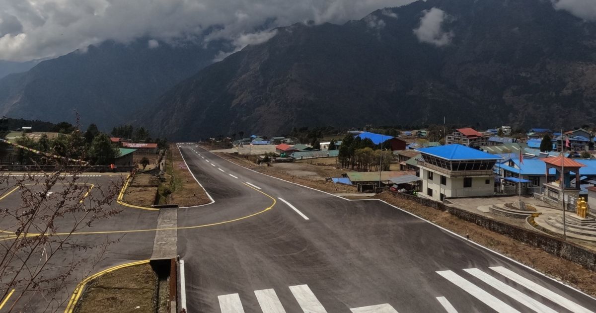
The total one-way distance from Lukla to Everest Base Camp is 65 km (40 miles). This 65 km stretch is divided into eight distinct days of uphill marching to ensure your safety. You cover an average of 8 km to 12 km per day during the first week of the trip. But the terrain gets considerably slower and more rocky after you pass the tree line at 4,000 m. The final push from the last lodge settlement involves walking over active glacial moraine, making this 65 km journey require immense physical endurance. Although the return portion is easier, the round trip from Lukla to EBC is 130 km, which is still not an easy feat.
Namche to Everest Base Camp
The raw distance to Everest Base Camp from Namche Bazaar is 45 km (28 miles). This 45 km section represents the most challenging and vertical portion of the entire expedition. You drop down into deep river gorges and climb up steep alpine ridges to pass through Tengboche, Dingboche, and Lobuche. Also, you gain exactly 1,924 m of vertical elevation between these two points. Because air pressure drops rapidly over this distance, we split the 45 km into five days of walking to allow your body to generate the necessary red blood cells.
Lobuche to Everest Base Camp
The round-trip distance from the high outpost of Lobuche to Gorak Shep to Everest Base Camp and back to Gorak Shep is 15 km (9.3 miles). You cover this 15 km stretch on Day 9 of the standard itinerary, which stands as your main summit milestone. The first 4.5 km section takes you over undulating dirt paths and loose scree to the final lodge outpost at Gorak Shep. Meanwhile, the remaining 10.5 km round-trip push to Base Camp requires navigating across slippery ice and giant boulders on the Khumbu Glacier. This distance takes roughly 8 hours to complete due to the extreme altitude and rugged ground.
Why Does the Everest Base Camp Trek Feel Longer Than the Distance?
The Everest trek spans roughly 130 km round-trip from Lukla. On paper, covering 10 km to 15 km a day sounds like a standard afternoon hike. But the numbers lie because they do not account for the vertical reality of the Himalayas. A flat city mile takes fifteen minutes. At high altitude, that same distance stretches across hours of steep switchbacks, loose moraine, and stone stairs. Your legs must accumulate a total of 8,400 m of fluctuating ascent across the entire journey. You climb up a ridge, drop down to a river suspension bridge, and immediately climb back up. This relentless gain and loss destroys your normal pacing.

The primary culprit is thin air. As you ascend, atmospheric pressure drops. The air still contains 21% oxygen, but the molecules are spaced much further apart. By the time you reach Everest Base Camp at 5,364 m, every breath delivers only half the oxygen available at sea level. Your lungs and heart must work twice as hard just to keep your muscles moving. Your body naturally demands a drastically slower pace, a strategy we call bistari, bistari (slowly, slowly). Attempting to rush through the thin air cuts your oxygen supply further and triggers altitude sickness. The physical strain multiplies, which makes a short 4 km stretch feel like a marathon.
Rough, technical terrain slows you down even further. Above the tree line, smooth dirt paths give way to unstable glacial moraine, shifting boulders, and slick ice. Every single step requires deliberate focus and balance, which drains your energy long before you reach the next teahouse. You are also wearing heavy trekking boots and carrying a daypack, both of which add resistance to an already exhausted frame. Meanwhile, you must frequently step aside on narrow ledge trails to yield to passing yak caravans. These frequent stops disrupt your rhythm and extend your time on the trail, making the distance feel twice as long as the map says.
Why does a 130 km distance take 8 days to ascend but only 3 days to descend?
The 130 km round-trip distance requires 8 days to ascend because your body must adjust to the rapid drop in air pressure. You start walking at 2,845 m in Lukla and climb up to 5,364 m at Everest Base Camp. If you walk this distance too quickly, your lungs cannot get enough oxygen, which can cause severe altitude sickness. We spread the uphill journey over 8 days to build in two mandatory rest periods in Namche and Dingboche. These rest stops do not advance your overnight altitude, which allows your blood to safely produce more red blood cells.
But the return journey takes only 3 days because your body can handle a faster rate of altitude drop. You are moving into areas with denser air and higher oxygen levels, so altitude sickness is no longer a concern. Likewise, gravity works in your favor on the long downhills, which allows you to cover up to 19 km in a single day. You do not need to pause for acclimatization stops on the way back to Lukla. Meanwhile, your leg muscles can maintain a much faster pace because each breath delivers more oxygen to your body than it did at the top.
How Difficult is the Everest Base Camp Trek Compared to Its Distance?
Covering over 100 km on a flat city path requires basic physical stamina. But the Everest Base Camp trek scales up the difficulty because you must cover that distance on high-altitude trails. You face steep stone steps, loose gravel paths, and slippery glacial moraine, all of which significantly slow your pace. Also, the thin air reduces the amount of oxygen reaching your muscles with every single step you take. This means a short 10 km daily march in the mountains demands the same energy as running a flat half-marathon at sea level.
Can Beginners Complete the Everest Base Camp Trek Distance?

You can absolutely complete the 130 km distance as a beginner, provided you prepare your body well in advance. The classic 14-day itinerarydoes not require any technical climbing skills, ropes, or mountaineering experience. But you must possess strong cardiovascular health and a resilient mindset to endure multiple days of consecutive walking. We design the daily stages to ensure you move slowly, which helps your body adapt to the altitude change. If you can handle walking on a treadmill or hiking local hills for 6 hours with a light pack, you can reach Base Camp safely.
Wondering About Trek Difficulty?
Learn about the altitude, daily walking hours, terrain, and physical demands to understand what to expect on the Everest Base Camp Trek.
How Should You Train to Handle the Everest Base Camp Trek Distance?
You should begin your training regimen at least 8 to 12 weeks before your scheduled departure date. Your main goal is to build cardiovascular endurance so your heart can pump oxygen efficiently in thin air. Likewise, you must strengthen your leg muscles to handle the continuous uphill climbs and steep downhill descents. Walking on inclined surfaces helps condition your joints for the high stone steps of the Khumbu region. Meanwhile, you should do all your training hikes while wearing the exact boots and daypack you plan to use on the trail.
- Cardio Workouts: Run, swim, or cycle for 45 minutes at least 3 to 4 times every week.
- Stair Climbing: Climb stairs or use a gym stair-master machine for 30 minutes to build your quad strength.
- Weighted Hikes: Complete a weekly 5-hour weekend hike while carrying a 5 kg to 8 kg daypack.
- Leg Strength Training: Perform regular sets of squats, lunges, and calf raises to protect your knees on descents.
What Are the Most Common Myths About the Everest Base Camp Trek Distance?
| S.No | Common Myth | True Trail Reality |
| 1 | You can easily shorten the distance by skipping the rest days. | The 130 km physical distance stays the same, but your body cannot adjust to the thin air without the mandatory rest stops in Namche (3,440 m) and Dingboche (4,410 m). |
| 2 | The daily distance feels exactly like walking a flat 12 km city road. | You are moving over steep stone stairs, loose gravel, and shifting glacial moraine. These obstacles double the time and energy needed for every kilometer. |
| 3 | Solo travelers cannot trek the distance alone anymore. | You cannot trek completely unsupervised, but 2026 regulations allow you to solo trek the distance, provided you hire a mandatory licensed guide. |
| 4 | The walk back down the valley takes longer because your muscles are tired. | You descend the 65 km return stretch in just 3 days because the higher oxygen density below the tree line speeds up your muscle recovery. |
| 5 | You need advanced technical climbing skills to complete the 130 km distance. | The entire route is a non-technical trek. You walk on established dirt paths, stone staircases, and rocky moraines without using ropes or ice axes. |
| 6 | Your booking price covers all your expenses from the moment you land in Nepal. | The mountain package covers your trek costs, permits, and mountain lodges. But your accommodation in Kathmandu is not included in the package price. |
Which Matters More on the EBC Trek: Distance or Altitude?
Which matters more on the Everest Base Camp trek depends entirely on how your body handles the thin air. The entire round-trip distance is a manageable challenge for anyone with basic cardiovascular fitness. You walk an average of 12 km per day, which sounds simple on flat ground. But the physical distance becomes secondary the moment you cross the 3,000 m threshold. The altitude changes the entire dynamic of the journey by altering how your body functions. A short 5 km walk at high elevation drains your energy faster than a 15 km hike at sea level.
Altitude is the factor that ultimately dictates your success or failure on this route. The atmospheric pressure drops as you ascend, which means every breath delivers fewer oxygen molecules to your muscles. By the time you reach Everest Base Camp at 5,364 m, the oxygen level drops to just 53% of sea-level capacity. This extreme deficit forces your heart and lungs to work twice as hard to sustain basic movement. You can easily train your legs to handle the physical distance before you leave home. But you cannot force your lungs to adapt to the thin air without a slow, deliberate ascent profile.
How Difficult Is the Everest Base Camp Trek in Terms of Altitude?

The altitude makes the Everest Base Camp trek a serious physical undertaking that requires strict safety protocols. You start your foot journey at 2,845 m in Lukla and climb continuously to a maximum height of 5,545 m at the top of Kala Patthar. This massive elevation gain exposes you to a high risk of acute mountain sickness (AMS) if you ascend too quickly. The thin air slows your physical recovery, causes mild headaches, and makes even simple uphill steps feel exhausting. Because of these severe physiological strains, you must follow an itinerary that includes mandatory rest days to let your blood safely generate more red cells.
What Permits Are Required for the Everest Base Camp Trek in 2026?
Trekking to Everest Base Camp requires two mandatory government permits to pass through the regional trail checkpoints. You must first obtain the Khumbu Pasang Lhamu Rural Municipality Local Encounter Permit, which is issued directly by the local government in Lukla. This local permit costs NPR 3,000 (approximately USD 23) per foreign national. Also, you must secure the Sagarmatha National Park Entry Permit to access the protected high-altitude conservation zones. This national park document costs NPR 3,000 plus 13% VAT, which totals exactly NPR 3,390 (approximately USD 26) per person.
The historical Trekkers' Information Management System (TIMS) card is no longer required for the Everest region, meaning you only pay for these two specific entry documents. Solo travelers can easily process these papers through our agency, but you cannot trek the route completely unsupervised. Current 2026 regulations state that independent hikers can solo trek the entire trek, provided they hire a mandatory licensed guide for safety. Our team manages the logistics for both permits in advance using your passport copies. Meanwhile, you must keep the original paper vouchers handy in your daypack because park rangers will verify them at checkpoints in Monjo and Jorsalle.
Not Sure What Permits You Need?
Learn about the permits required for the Everest Base Camp Trek, where to get them, and what you need to prepare before starting your journey.
What Are the Best Map Resources and GPS Tools for the Everest Base Camp Trek?
Navigating the Everest Base Camp trail requires a reliable mix of digital tracking applications and physical reference maps. Most modern trekkers rely on offline smartphone applications like Maps.me or AllTrails to track their progress between the high-altitude villages. You must download the complete Khumbu regional map files while you still have strong Wi-Fi access in Kathmandu. These digital applications display the main trail lines, lookouts, and teahouse locations on your phone's built-in GPS. But you must remember that cold mountain temperatures drain smartphone batteries rapidly above the tree line.
To prevent navigation failures, you should always carry a physical topographic map as your primary backup system. We recommend buying a high-resolution 1:50,000-scale paper map in Thamel before you start your journey. These paper maps show detailed contour lines, minor trail junctions, and precise elevations for major waypoints like Lukla at 2,845 m and Gorak Shep at 5,164 m. Also, dedicated satellite communication devices like the Garmin inReach Mini 2 offer excellent tracking capabilities in deep river gorges. These premium tools let you share your live location with family members via satellite networks. Meanwhile, they give you access to real-time weather alerts when internet services drop out.
Does a GPS Step Tracker Work Accurately on the Everest Base Camp Trail?
A standard GPS step tracker works well on open paths, but its accuracy drops significantly on the rugged upper sections of the Everest trail. The massive mountain walls and deep river canyons can block satellite signals, which causes your device to miscalculate your actual distance. Likewise, standard wrist trackers count steps based on forward arm movement but fail to account for the terrain's verticality. You move much more slowly on steep stone steps and loose glacial moraine than you do on flat city streets. This means your device might show you walked fewer kilometers than the map says, even though your body expended twice the energy.
Duration:18 DaysStart fromUSD 1999USD 1865based on 6 reviews
EBC Distance vs Other Classic Treks
The Everest Base Camp trek requires a unique pacing approach compared to other global routes. On a standard sea-level trail, you can easily walk 15 km in a few hours. But the high-altitude terrain of the Khumbu region forces you to break this distance down into smaller daily segments. Other classic trails cover more total mileage but have a much lower maximum elevation. This means you must prepare for thin air, not just the physical length of the path.
| Trek | Approx. Distance | Duration | Walking Hrs/days | Maximum Altitude | Difficulty Level | Terrain Type |
| Everest Base Camp (Nepal) | 130 km | 12-14 days | 5-7 hours | 5,545 m | Strenuous | Glacial moraine and stone steps |
| Annapurna Circuit (Nepal) | 160-230 km | 12-18 days | 6-7 hours | 5,416 m | Strenuous | Dirt roads and mountain passes |
| Inca Trail (Peru) | 42 km | 4 days | 6-8 hours | 4,215 m | Moderate | Stone paving and mountain steps |
| Kilimanjaro - Machame (Tanzania) | 62 km | 7 days | 5-9 hours | 5,895 m | Strenuous | Scree fields and alpine desert |
| Tour du Mont Blanc (Europe) | 170 km | 11 days | 5-7 hours | 2,665 m | Moderate | Groomed dirt paths and alpine meadows |
Have Questions About Your Trek?
Get quick answers about routes, costs, permits, difficulty, or travel dates from our trekking team before you book.
Conclusion
Completing the Everest Base Camp trek is an attainable goal for average hikers who prepare their bodies well in advance. The physical length of the mountain path remains exactly the same whether you choose a short 9-day sprint or a classic 14-day itinerary. But your safety on this rugged terrain depends entirely on how many days you allocate to handle the altitude changes. A longer schedule lets you spread the mileage into manageable segments, keeping your daily walking time under 6 hours. Likewise, it provides your lungs with the rest days they need to safely adapt to the dropping atmospheric pressure.
Contact our team today to secure your licensed mountain guide and customized 2026 itinerary for the Everest Base Camp Trek.