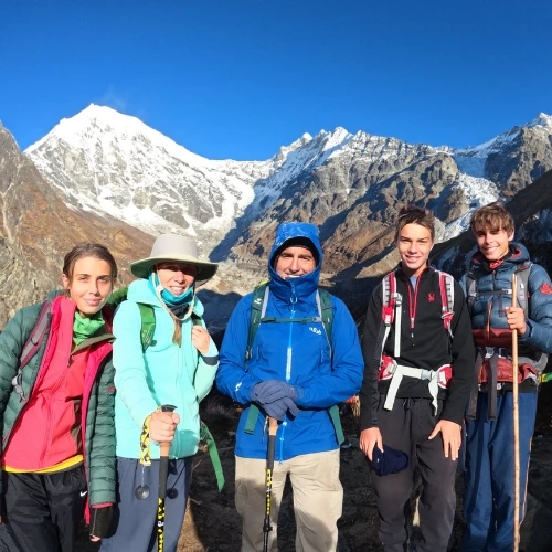
The Upper Mustang altitude ranges from 2,800 m (9,186 ft) at Kagbeni, the gateway to the restricted region, to 4,660 m (15,290 ft) at Kora La Pass on the Nepal–Tibet border. Most of the trek takes place between 3,500 m and 4,000 m (11,500–13,100 ft), where oxygen levels are much lower than at sea level.
The main destination, Lo Manthang, is situated at 3,840 m (12,598 ft) above sea level. It is one of the highest permanently inhabited walled towns in Nepal. On the standard Upper Mustang trek, the highest point is Nyi La Pass at 3,932 m (12,900 ft). The pass is crossed while trekking between Ghami and Tsarang before descending to lower elevations.
Quick Facts About Upper Mustang Altitude
Average trekking altitude: 3,500–4,000 m above sea level.
Starting point (Kagbeni): 2,800 m (9,186 ft), the gateway to Upper Mustang.
Main destination (Lo Manthang): 3,840 m (12,598 ft), the ancient walled capital of the former Kingdom of Lo.
Highest point on the standard trek: Nyi La Pass3,932 m (12,900 ft).
Maximum elevation in Upper Mustang: Kora La Pass 4,660 m (15,290 ft) on the Nepal–Tibet border.
Elevation gain: Around 1,860 m (6,102 ft) from Kagbeni to Kora La Pass.
Above 3,000 m: Most villages and trails lie above 3,000 m, where altitude starts to affect many trekkers.
Risk of altitude sickness: Moderate
Terrain: A high-altitude trans-Himalayan desert with dry villages and colorful cliffs.
Best acclimatization stop: Spending an extra night in Lo Manthang helps before exploring higher areas like Nyi La or Kora La.
Trek Upper Mustang With Confidence
ve questions about Upper Mustang altitude, acclimatization, or trek conditions? Talk to our trekking experts for practical advice and planning help.
What is the Day-by-Day Elevation Gain on the Upper Mustang Trek?
Knowing where you'll stay each night and how much altitude you'll gain each day helps you prepare for the Upper Mustang Trek. The table below details the exact elevations of main settlements and checkpoints on the standard trekking route.
Day
Route
Starting Altitude
Ending Altitude
Approx. Distance
Highlights
1
Kathmandu to Pokhara
1,400 m
820 m
200 km
International Arrival and travel to the transit Hub of Lower Mustang
2
Pokhara to Jomsom to Kagbeni
820 m
2,800 m
164 km
Airfield & Trek Starting Point to Restricted Area Gateway & Checkpoint
3
Kagbeni to Chuksang
2,800 m
2,980 m
20 km
Village located at the junction of Narshing Khola and Kali Gandaki
4
Chuksang to Samar Village
2,980 m
3,150 m
6.6 km
Gateway to high-altitude canyons, and home to the ancient Samar Monastery
5
Samar to Ghiling
3,150 m
3,510 m
15 km
Houses the 15th-century Thrangu Tashi Choling monastery
6
Ghiling to Tsarang
3,510 m
3,932 m
28 km
Ancient Capital Site & Red Gompa
7
Tsarang to Lo-Manthang
3,932 m
3,840 m
11 km
Walled Capital City of Lo
8
Rest day in Lo-Manthang
3,840 m
3,840 m
-
Visit Choser Cave and Namgyal Monastery
9
Lo-Manthang to Dhakmar
3,840 m
3,810 m
17.2 km
Famous for crimson cliffs and the 8th-century Ghar Gompa
10
Dhakmar to Syanbochen
3,810 m
3,475 m
23 km
Acclimatization stops before crossing Taklam La (3,624 m) and Dajori La (3,735 m) passes
11
Syanbochen to Chusang
3,475 m
2,980 m
13 km
Known for ancient cliff caves, monasteries, and green farming valleys.
12
Chusang to Muktinath
2,980 m
3,762 m
15 km
Lord Bishu Temple, Place of Liberation (Mukti Kshetra) with 108 waterspouts
13
Muktinath to Jomsom
3,762 m
2,743 m
20 km
Capital of Mustang District with modern lodges, amenities, and access to Nepal Trekking Permits
14
Jomsom to Pokhara
2,743 m
820 m
160 km
Adventure and Tourism Hub, starting point for Annapurna Circuit and Annapurna Base Camp.
15
Pokhara to Kathmandu
820 m
1,400 m
200 km
Final Destination
How does the Altitude Profile of Upper Mustang Look Like?
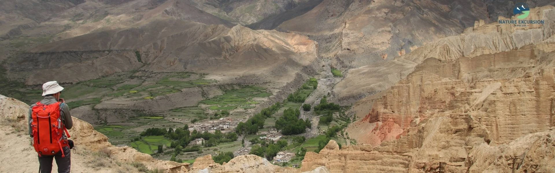
Kagbeni
The altitude profile of Upper Mustang is slow and steady that climbs from the lower river valleys up onto a massive high-altitude plateau. Unlike the sharp, vertical elevation gain of the Everest or Annapurna Circuit treks, Upper Mustang climbs slowly. The route follows a pattern of crossing high passes, followed by a short downhill walk into protected valley settlements, where you spend the night.
Starting Elevation: Where the Journey Begins
Your journey officially starts in Jomsom at 2,720 m.
The Flight/Drive Gateway: Most travelers take a short flight or a drive from Pokhara to Jomsom to start the trip.
The Restricted Gate: From Jomsom, you move to Kagbeni at 2,810 m. Kagbeni is the baseline of the Upper Mustang region and is home to the official government checkpoint where your restricted area permit is verified.
Highest Point Reached During the Trek
The absolute highest point you will cross on the standard trekking circuit is the Nyi La Pass at 3,932 m.
The Peak of the Journey: This pass connects the regions of Tsarang and Syanbochen. It offers beautiful views of the Annapurna and Dhaulagiri mountain ranges looking south.
Side-Trip High Points: If you choose to explore the sky caves or the Tibetan border wall near Chhoser by foot or horseback, you may reach altitudes up to4,100 m.
Why does the Upper Mustang altitude feel tougher than it looks on paper?
Although the highest point of the Upper Mustang trek is only 3,932 m at Nyi La Pass, many trekkers find it more difficult than they expect. The challenge comes from the dry climate, powerful winds, and open geography rather than altitude alone. Strong winds build through the Kali Gandaki Gorge after late morning and can reach 40 to 60 km/h.
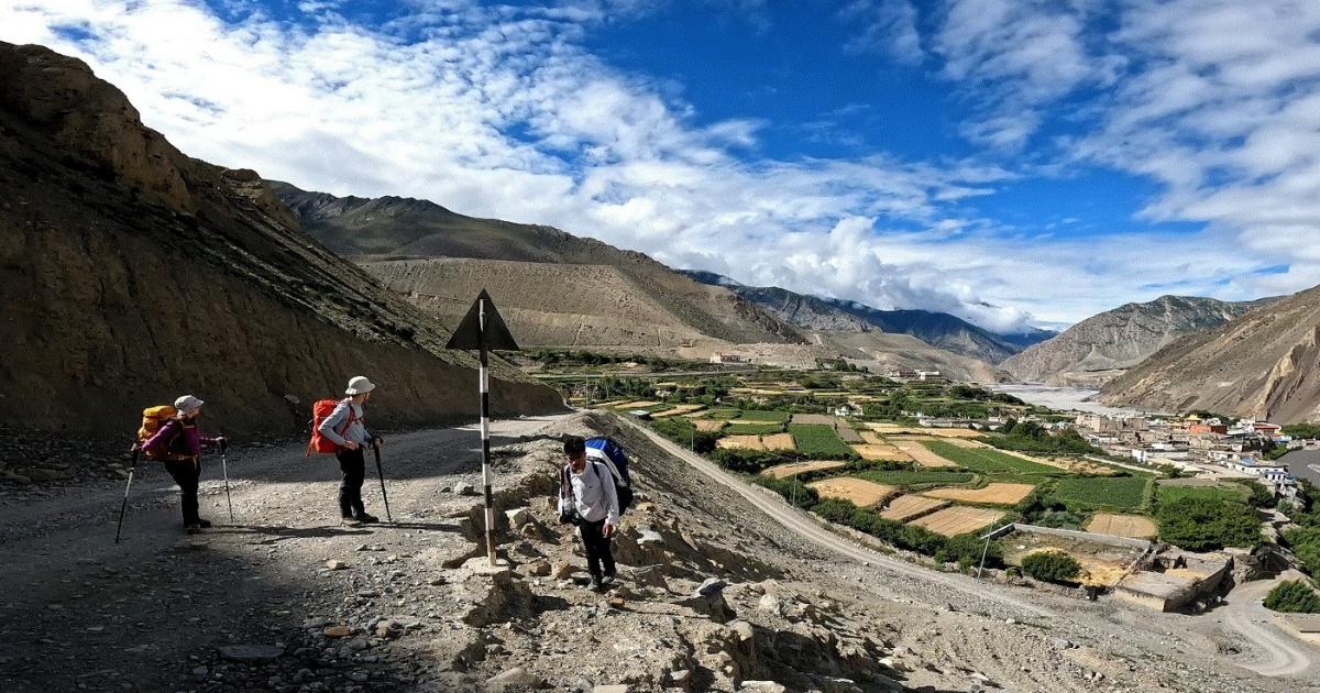
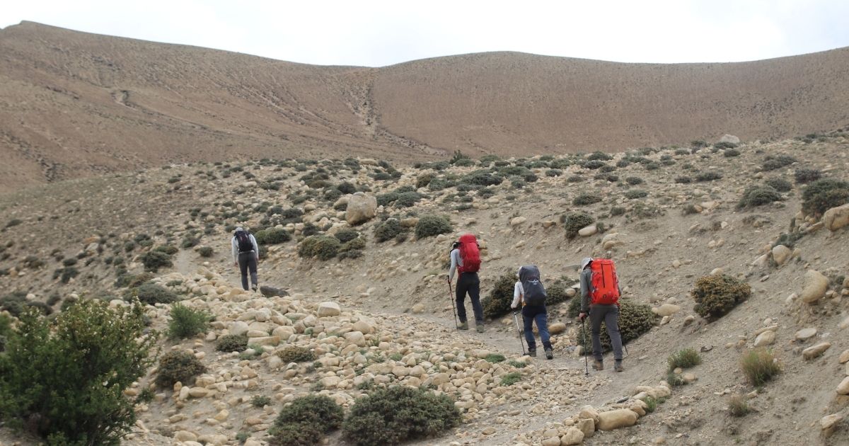
Ghiling to Tsarang
The dry air also increases the physical challenge because your body loses water more quickly than you notice. Many trekkers become mildly dehydrated without realizing it because sweat evaporates immediately in the low-humidity environment. At the same time, the thin mountain air permits stronger ultraviolet rays to reach the ground, which increases the risk of sunburn and fatigue during the day.
Can Beginners Handle the Altitude in Upper Mustang?
Yes, most beginners can handle the altitude in Upper Mustang if they are fit and follow a proper trekking itinerary. The standard route starts slowly from Jomsom to Lo Manthang before reaching its highest point at Nyi La Pass. This gradual gain in elevation gives the body enough time to adjust to thinner air and lowers the risk of altitude sickness compared with treks that climb above 5,000 m.
Does a Jeep tour remove the risk of altitude sickness in Upper Mustang?
No, a jeep tour does not remove the risk of altitude sickness in Upper Mustang. Altitude sickness occurs because the amount of oxygen in the air decreases as you gain elevation. This happens whether you travel on foot or by vehicle. In fact, a jeep tour can sometimes increase the risk because it climbs much faster than a trekking itinerary.
A jeep tour does reduce physical effort because you are not walking for several hours each day. However, it does not change the altitude or increase the amount of oxygen available at higher elevations. Once you leave the vehicle at places above 3,500 m, your body still has to adapt to thinner air. This is why many Upper Mustang jeep itineraries include overnight stops before reaching Lo Manthang.
Altitude Sickness Symptoms and Prevention During the Upper Mustang Tour
The most common symptoms of altitude sickness appear within 6 to 24 hours after reaching a higher elevation. Early signs are headache, dizziness, tiredness, shortness of breath, loss of appetite, nausea, vomiting, poor sleep, and fatigue.
If these symptoms become worse, they may develop into a serious medical emergency with severe breathlessness, difficulty walking in a straight line, confusion, persistent cough, chest tightness, or loss of consciousness. Follow these preventive measures to avoid them:
Do not increase your sleeping elevation by more than 300 to 500 m per night
Spend at least two nights at Lo Manthang before moving higher
During your afternoon rest periods, walk up a nearby viewpoint that is 150 to 200 m higher than your village rest for 30 minutes, and then come back down to sleep
Drink 3 to 4 liters of water daily to reduce the risk of dehydration
Eat high-carbohydrate meals to metabolize more than proteins and fats
Avoid alcohol and sleeping pills because both can slow your breathing while you sleep
Consult your doctor before a trip to make sure your health is suitable for the high-altitude environment of Upper Mustang
How should you prepare and train for the Upper Mustang altitude?
To prepare for the high altitude of Upper Mustang, you should focus on improving your cardiovascular fitness, strengthening your legs, and increasing lung capacity. Follow these methods to get ready for your journey:
Find local hills, load a backpack with 5–8 kg (11–17 lbs), and hike for several hours on weekends
Set a treadmill to a high incline (10–15%) and walk at a slow speed
Practice slow jogging, cycling, or swimming for 45 to 90 minutes
Step onto a 12-inch bench while wearing your loaded backpack. Aim for 100–200 steps per leg
Practice rhythmic breathing during workouts (e.g., inhale for two steps, exhale for two steps) to keep your heart rate from spiking
Pack clothing for changing temperatures, since warm days can quickly turn into cold nights
Sleep well and eat balanced meals before and during the trek to maintain your energy
Plan an Upper Mustang Trip That Fits You
Want more flexibility? Adjust your Upper Mustang itinerary, trekking days, stops, and activities to match your travel preferences.
The best time to trek in Upper Mustang is during spring (March to May) and autumn (September to November). Daytime temperatures fluctuate between 15°C and 22°C in spring, while autumn offers one of the best mountain visibility of the entire year. Spring is especially popular because the three-day Tiji Festival is held in Lo Manthang during May.
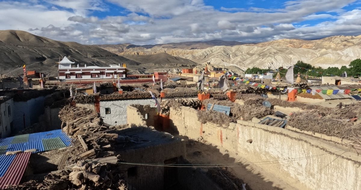
Lo Manthang Village
Unlike most trekking regions in Nepal, Upper Mustang is also a great destination during the monsoon season (June to August) because it lies in the Himalayan rain shadow. While many popular trails receive heavy rainfall and face landslides, Upper Mustang stays dry with good trekking conditions. In contrast, winter (December to February) is the least favorable season. Temperatures can fall to -20°C (-4°F) in higher areas, and many lodges close as local families move to lower elevations until spring returns.
How Does Upper Mustang's Altitude Affect Winter vs. Summer Trekking?
At an altitude of around 3,800 m, summer is more comfortable than many trekkers expect. Daytime temperatures range from 13°C to 20°C, while nights fall to around 0°C. Oxygen levels are the same as in other seasons because altitude does not change. However, the dry mountain air increases water loss through breathing and sweating.
During winter, the same altitude becomes much more challenging because of extreme cold. Cold air can make breathing difficult, even though the oxygen percentage stays the same. Snow also covers high passes such as Nyi La Pass and may block trekking trails or jeep roads for several days.
Upper Mustang Altitude Compared to Everest Base Camp and Annapurna Circuit
The table below breaks down how the altitude profile and environment of Upper Mustang stack up against the two most famous trekking routes of Nepal, like Everest Base Camp and Annapurna Circuit:
Trek
Maximum Altitude
Approx. Distance
Duration
Difficulty Level
Geography Type
Upper Mustang
Nyi La Pass (3,932 m)
125 km (Loop circuit)
12-15 days
Moderate and beginner-friendly
Semi-arid desert, dusty tracks, and canyons
Everest Base Camp
Kala Patthar (5,555 m)
130 km (Out-and-back)
12-14 days
Strenuous
Alpine forests, glacial moraines, ice fields
Annapurna Circuit
Thorong La Pass (5,416 m)
160–230 km
9-18 days
Challenging
Green valleys shifting to high-alpine rocky passes
Conclusion
Trekking in Upper Mustang needs careful planning and proper acclimatization. Attempting this trek without professional support increases your risks in a region where emergency medical assistance is hours away.
Nature Excursion offers fully supported Upper Mustang treks led by trained guides who carry first-aid kits and pulse oximeters to monitor your health at high altitude. Our itineraries are designed with safe acclimatization so that you can focus entirely on the culture and desert landscapes of the Forbidden Kingdom.
Contact us today to arrange your restricted area permits and start planning your Upper Mustang adventure.
FAQs
Is Acute Mountain Sickness (AMS) common at Upper Mustang's elevation?
Yes, Acute Mountain Sickness (AMS) is fairly common in Upper Mustang, above 2,500 m. Most of the region lies between 2,800 and 4,000 m, where the risk increases. Trekkers who ascend too quickly are more likely to develop AMS.
Why does the "Mustang Cough" happen at a lower altitude than the "Khumbu Cough"?
Because Upper Mustang winds carry fine, dry dust that irritates your airways. Unlike Khumbu Cough, which is caused by cold, thin air above, Mustang Cough can develop around 3,200 m due to constant exposure to alkaline dust from the Kali Gandaki valley.
Does the high altitude cause sudden dental pain in Upper Mustang?
Yes, the significant drop in atmospheric pressure causes tiny air pockets trapped beneath old dental fillings to expand. In the bone-dry desert climate, this pressure can trigger sharp toothaches, a condition known as barodontalgia.
How does the high altitude affect electric vehicle (EV) ranges in Mustang?
Cold temperatures at high altitude can reduce an EV's battery range by 20%–30%. Unlike petrol or diesel engines, EV motors are not affected by thin air, but cold weather slows the chemical reactions inside lithium batteries.
Why do local pack animals (horses/mules) rarely suffer from AMS here?
They are naturally adapted to high altitudes. Native horses and mules have larger hearts, higher hemoglobin levels, and greater lung capacity, so they can carry heavy loads above 4,000 m without suffering from altitude sickness.
Written by
Raju GurungMD
Gurung is the founder and managing director of ‘Nature Excursion Pvt. Ltd.’ The mountains and hills from his village, Rubi Valley, always had him wondering, and he became one of the travel enthusiasts from his early childhood.
Upper Mustang is one of the few places in Nepal where you can still experience ancient traditions, Tibetan culture, and remote Himalayan landscapes un...
The total cost of an Upper Mustang trek typically ranges between $1,300 and $3,500+ USD per person for a standard 10-to-14-day itinerary, heavily infl...
The main autumn treks in Nepal are Everest Base Camp, the Annapurna Circuit, Annapurna Base Camp, the Manaslu Circuit, Langtang Valley, and Mardi Hima...




.webp)
.webp)