Where Is Tilicho Lake Located
Quick Facts About Tilicho Lake
- Elevation: 4,919 m.
- Location: Manang District, Nepal.
- Length: 4 km (2.5 miles).
- Width: 1.2 km (0.75 miles).
- Average Depth: 85 m (279 feet).
- Water Source: Glacial melt from Tilicho Peak.
- Religious Value: Holy site in Hinduism (Ramayana).
- Trek Difficulty: Strenuous
- Best Season: September to November; March to May
Planning a Trip to Tilicho Lake?
Have questions about the route, trekking duration, best time to visit, or how to add Tilicho Lake to the Annapurna Circuit? Talk to our trekking experts on WhatsApp for personalized guidance.
Tilicho Lake Geographic Location in Nepal
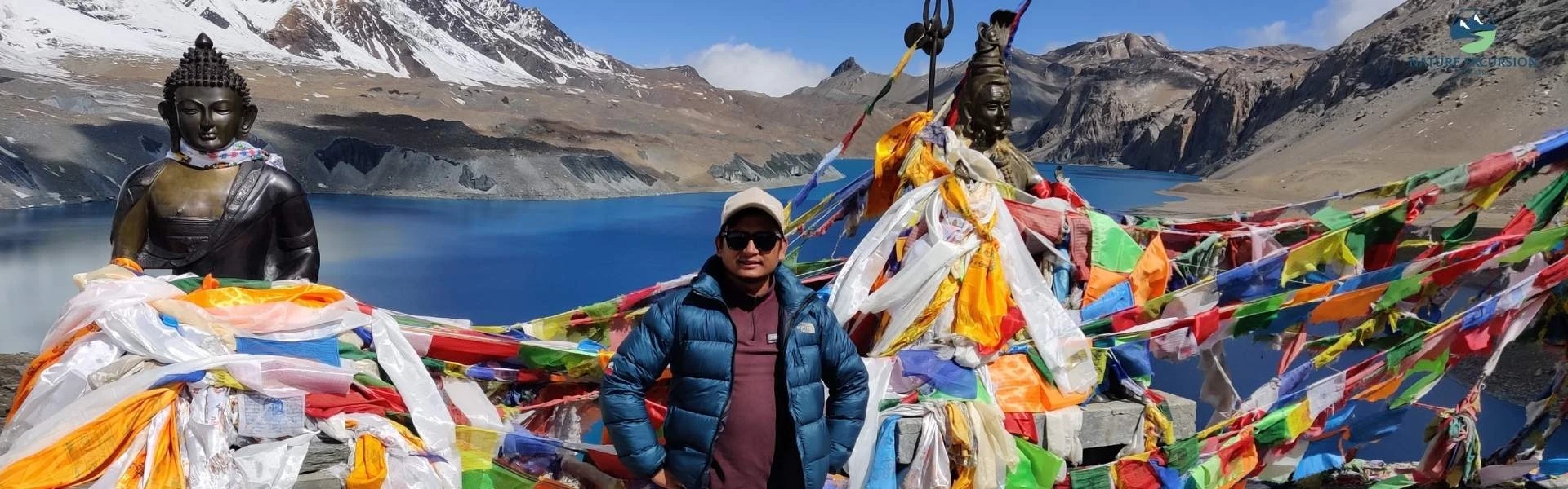
Tilicho Lake lies in north-central Nepal at coordinates 28.69° N latitude and 83.85° E longitude. The lake is situated at an elevation of 4,919 m within a remote basin on the northern side of the Annapurna Himalayan Range. This entire area falls inside the Annapurna Conservation Area, the largest protected region of Nepal, which covers more than 7,600 sq. km. Geographically, Tilicho Lake is in the rain-shadow zone beyond the main Himalayan barrier.
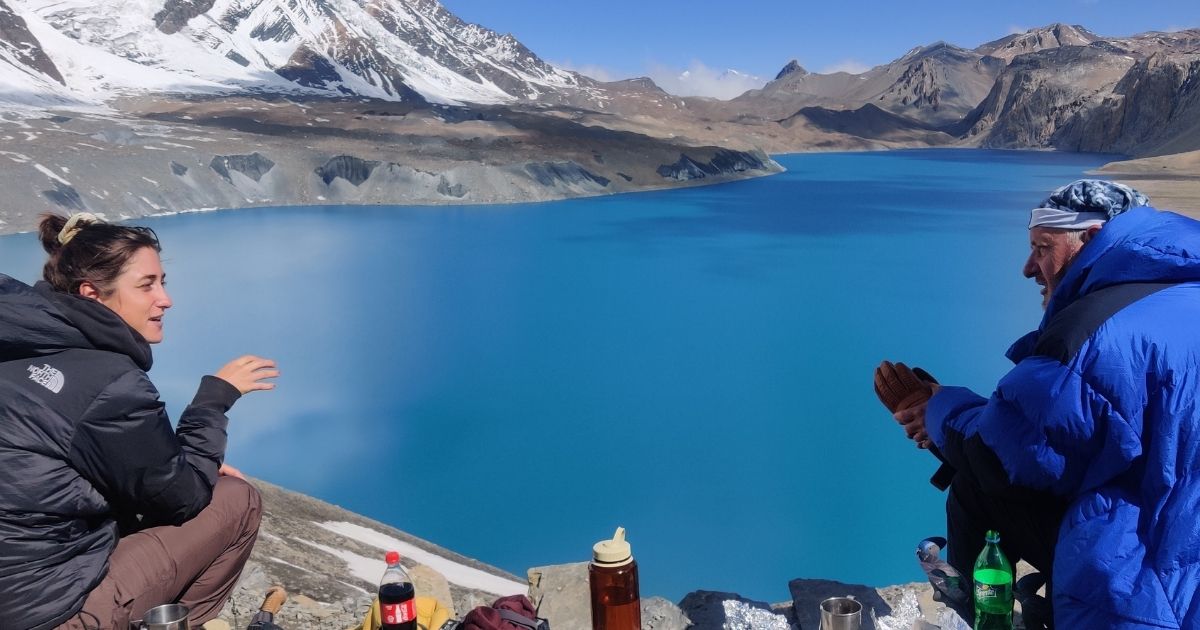
The lake is surrounded by some of the highest mountains in the Annapurna region. Tilicho Peak lies to its northwest, the Nilgiri Himal to the north, and Gangapurna and Khangsar Kang to the east. One of the most interesting geographical features of Tilicho Lake is that it has no visible surface outlet river. Scientists believe that excess water leaves the lake through underground drainage channels before reaching the Marshyangdi River basin.
Which Trek Takes You to Tilicho Lake?
Tilicho Lake can be reached through two main trekking options: the Annapurna Circuit Trek with Tilicho Lake and the Tilicho Lake Trek as a standalone adventure. While most trekkers visit the lake as a side trip during the Annapurna Circuit, it can also be explored as a dedicated trek. Let's look at them in detail.
Tilicho Lake via Annapurna Circuit Trek

For the Tilicho Lake trek via ACT, trekkers leave the main circuit at Manang (3,540 m), follow a separate trail through Siri Kharka and Tilicho Base Camp to reach the lake, and then return to the main route before continuing toward Thorong La Pass (5,416 m).
| Day | Route | Starting Altitude | Ending Altitude | Approx. Distance | Walking Time | Difficulty |
|---|
| 6 | Manang → Khangsar | 3,540 m | 3,756 m | 9-11 km | 6-7 hours | Challenging |
| 7 | Khangsar →Tilicho Base Camp | 3,756 m | 4,150 m | 12 km | 8 hours | Challenging |
| 8 | Tilicho Base Camp → Siri Kharka → Ledar | 4,150 m | 4,200 m | 12 km | 6-7 hours | Moderate to challenging |
| 9 | Ledar → High Camp | 4,200 m | 4,880 m | 8 km | 4 hours | Challenging |
| 10 | High Camp → Muktinath | 4,880 m | 3,760 m | 16-17 km | 8-9 hours | Very challenging |
| 11 | Muktinath → Pokhara | 3,760 m | 830 m | 173 km | 8-10 hours | Easy |
Duration:12 DaysStart fromUSD 1250USD 1153based on 12 reviews
Tilicho Lake Trek as a Standalone Adventure
Tilicho Lake can also be completed as a standalone trek for travelers who want to focus on the lake without crossing Thorong La Pass or completing the full Annapurna Circuit. The route follows the same trail from Besisahar and Manang to Tilicho Lake before returning the same path.
| Day | Route | Starting Altitude | Ending Altitude | Approx. Distance | Walking Time | Difficulty |
|---|
| 1 | Kathmandu → Besisahar | 1,400 m | 760 m | 175 km | 6-7 hours | Easy |
| 2 | Besisahar → Chame (drive) | 760 m | 2,610 m | 70 km | 5-6 hours | Easy |
| 3 | Chame → Upper Pisang | 2,610 m | 3,300 m | 14 km | 5-6 hours | Moderate |
| 4 | Upper Pisang → Manang | 3,300 m | 3,540 m | 16 km | 6-7 hours | Challenging |
| 5 | Manang → Tilicho Base Camp | 3,540 m | 4,150 m | 14 km | 6-7 hours | Challenging |
| 6 | Tilicho Base Camp → Tilicho Lake Excursion | 4,150 m | 4,919 m | 6 km | 4 hours | Challenging |
| 7 | Return to Manang | 4,150 m | 3,540 m | 17 km | 6-7 hours | Moderate |
How Far Is Tilicho Lake From Popular Destinations?
Let's find out how far Tilicho Lake is from some of the most popular places in Nepal.
| Starting Point | Access Method | Approximate Duration |
|---|
| Kathmandu | Bus/Jeep to Khangsar + Trekking | 6 to 10 Days |
| Pokhara | Bus/Jeep to Khangsar + Trekking | 5 to 7 Days |
| Besisahar | Off-road Jeep + Trekking | 4 to 5 Days |
| Butwal | Highway Drive + Jeep + Trek | 7 to 9 Days |
| Biratnagar | Long Highway Drive + Jeep + Trek | 8 to 11 Days |
| Nepalgunj | Highway Drive + Jeep + Trek | 8 to 10 Days |
| Dhangadhi | Long Highway Drive + Jeep + Trek | 9 to 12 Days |
| Mahendranagar | Long Highway Drive + Jeep + Trek | 9 to 12 Days |
| Janakpur | Highway Drive + Jeep + Trek | 7 to 9 Days |
Need a Trek Plan That Fits Your Dates?
Have fixed travel dates? Get a Tilicho Lake trek plan tailored to your schedule, preferred season, and trekking goals.
What to Expect When You Reach Tilicho Lake?
When you reach Tilicho Lake, expect a remote high-altitude environment with very limited facilities, thin air, and beautiful mountain scenery. The main things you can expect are explained below.
Minimal Infrastructure
There are no places to stay, eat, or buy water at the lake itself. During peak trekking seasons, a tiny temporary shack near the viewpoint may sell hot tea at premium prices, but it is not always guaranteed. Because sleeping at this altitude is very dangerous, you will only spend 30 to 45 minutes taking photos before immediately hiking back down to Tilicho Base Camp for safety.
Thin Air and Extreme Physical Exhaustion
With oxygen levels 50% lower than at sea level, simple movements feel heavy here. You can expect to feel instantly out of breath just walking on the shore. The basin of Tilicho acts as a natural funnel for icy Himalayan winds. Even on a clear, sunny morning, temperatures can feel well below freezing.
Mountains Surrounding Tilicho Lake
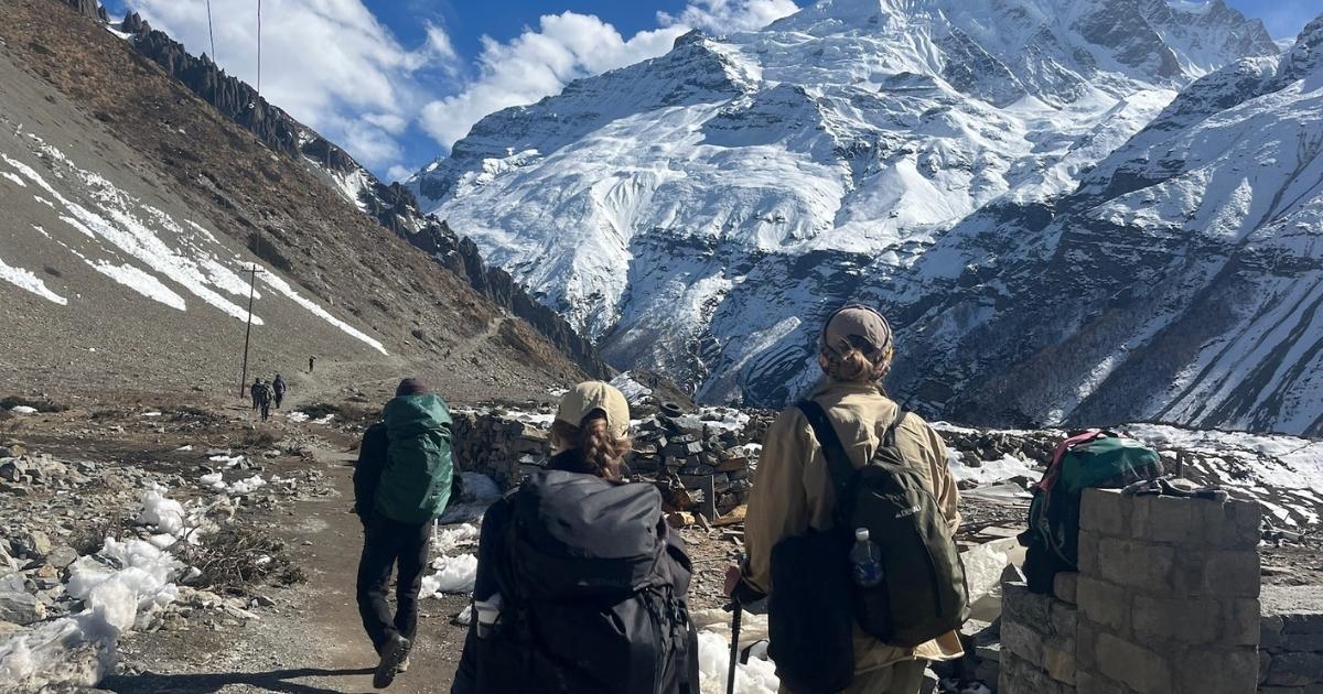
The lake is entirely enclosed by some of the tallest peaks and glaciers of the Annapurna range.
| Mountain | Altitude |
| Tilicho Peak | 7,134 m |
| Nilgiri North | 7,061 m |
| Gangapurna | 7,455 m |
| Khangsar Kang (Roc Noir) | 7,485 m |
| Annapurna III | 7,555 m |
| Annapurna II | 7,937 m |
What Is the Hindu Mythological Significance of Tilicho Lake?
Tilicho Lake holds a special place in Hindu tradition because many devotees identify it as the ancient Kak Bhusundi Sarovar mentioned in the Ramayana. According to Hindu belief, Sage Kak Bhusundi lived near this lake after receiving the blessing of immortality from Lord Rama. The legend says that he took the form of a crow and spent countless ages reflecting on the life and teachings of Lord Rama.
Hindu traditional stories describe this lake as the place where Kak Bhusundi shared the story of the Ramayana with Garuda (the eagle and vehicle of Lord Vishnu). The religious importance of Tilicho Lake extends beyond the story of Kak Bhusundi. Local traditions also connect the lake with the Pandavas from the Mahabharata, who are believed to have passed through this high Himalayan region during their years of exile.
Is Tilicho Lake Trek Difficult?
Yes, the Tilicho Lake Trek is difficult. The factors that affect its difficulty are high-altitude, landslide-prone areas, and long trekking hours. The lake sits at 4,919 m, where the amount of available oxygen is about half of what people experience at sea level. Because of this, even fit trekkers can feel short of breath, tired, or develop symptoms of altitude sickness.
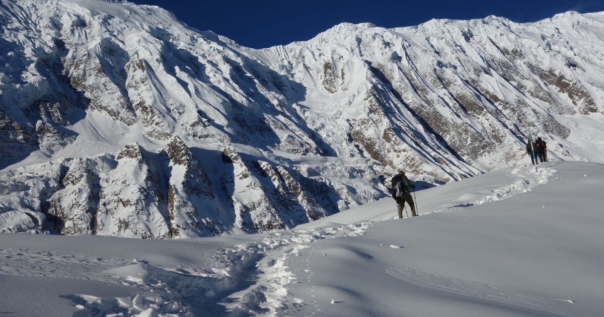
Another major challenge is the crossing of rough trails between Shree Kharka, Tilicho Base Camp, and Tilicho Lake. The hardest day is the hike from Tilicho Base Camp to the lake. The trek starts around 4:00–5:00 a.m. and climbs nearly 800 m in elevation before reaching the lakeshore.
Wondering How Difficult Tilicho Lake Trek Is?
Want to know what to expect on the trail? Learn about the trekking difficulty, altitude, terrain, daily walking hours, and preparation needed for the Tilicho Lake Trek.
What Are the Best Altitude and Acclimatization Tips for the Tilicho Lake Trek?
- Take the Manang Rest Day: Use this day for an acclimatization hike up to Gangapurna Lake or Ice Lake, then sleep back down in Manang
- Cap Your Daily Altitude Gains: Once you cross 3,000 m, aim to increase your sleeping altitude by no more than 300 to 500 m per night
- Avoid Dehydrating Fluids: Avoid alcohol, excessive caffeine, and sleeping pills throughout the trek
- Do Not Carry Excess Weight: Keep your daypack as light as possible. If you are not an experienced alpine hiker, hire a local porter.
- Consider Preventive Diamox: Consult your doctor before your trip about taking Acetazolamide (Diamox)
- Never Ascend with Symptoms: If you develop a mild headache that does not fade after drinking water and resting, do not trek any higher.
What Is the Best Time to Visit Tilicho Lake?
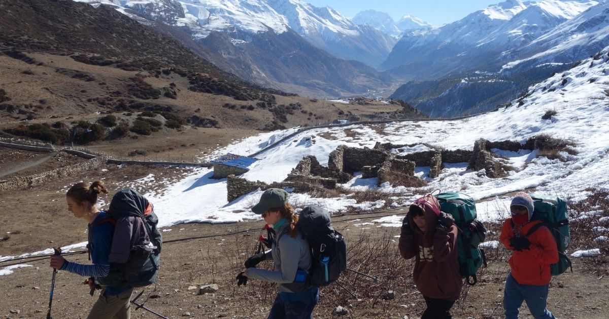
The best time to visit Tilicho Lake is duringspring (March to May) and autumn (September to November).Autumn is considered the best overall season because the skies are at their clearest after the monsoon rains.
| Season | Best for | Recommendation |
|---|
| Autumn (Sep-Nov) | Beautiful Himalaya panoramas and cloudless skies | Yes. Trails are dry, the landslide zones are stable, and the lake shows its turquoise color. |
| Spring (Mar-May) | Rhododendron blooms & snow-capped peaks | Yes. The lake may still be partially frozen in March, melting fully by May |
| Winter (Dec-Feb) | Empty trails & top alpine adventure | Yes, but careful. Temperatures at the lake drop well below -20°C (-4°F). Teahouses at Base Camp close due to freezing water pipes and heavy snowfall. |
| Monsoon (Jun-Aug) | Greenery, heavy clouds & rain | Dangerous, while the lake lies partly in a rain shadow, the access roads from Besisahar and trails up to Manang suffer from landslides. |
Tilicho Lake vs Other High-Altitude Lakes in Nepal
The table below compares Tilicho Lake with seven other famous high-altitude lakes in Nepal, ranked from the highest to the lowest elevation.
| Lake | Elevation | Region | Popular For |
|---|
| Tilicho Lake | 4,919 m | Annapurna Region | Turquoise glacier water, Tilicho Peak wall, part of Ramayana mythology |
| Gokyo Lakes | 4,700 m – 5,000 m | Everest Region | A system of six interconnected alpine lakes |
| Panch Pokhari | 4,100 m | Langtang Region | A group of five sacred lakes |
| Gosaikunda Lake | 4,380 m | Langtang Region | A revered Shiva pilgrimage site connected with the myth of the Samudra Manthan |
| Shey Phoksundo Lake | 3,611 m | Lower Dolpo Region | A deep-blue lake with absolutely no aquatic life |
| Rara Lake | 2,990 m | Mugu District | The largest and deepest freshwater lake in Nepal |
| Cho Rolpa | 4,580 m | Rolwaling Valley | One of the largest pro-glacial lakes in Nepal |
| Tsho Rolpa / Ice Lake (Kicho Tal) | 4,600 m | Annapurna Region | A day-hiking lake used by trekkers in Manang Village for altitude acclimatization. |
Duration:14 DaysStart fromUSD 1200USD 1099based on 16 reviews
Why Should You Plan Your Tilicho Lake Trek with Nature Excursion?
Nature Excursion offers an organized Tilicho Lake trekking package that covers the essential logistics needed for the journey. Here's what our services include:
- Government-licensed trekking guide accompanies the group throughout the trek.
- Porter support is available to carry trekking luggage during the journey.
- Transportation is organized between Kathmandu, Besisahar, Chame, Muktinath, and Pokhara according to the itinerary.
- Accommodation is included in trekking lodges along the route, as well as selected hotel stays before and after the trek.
- A basic medical kit, water purification tablets, and an oximeter are carried by the guide to assist with health monitoring on the trail.
- Trekking gear such as a sleeping bag, down jacket, and duffle bag can be provided on request.
- Rescue coordination assistance is available in case of serious altitude or health-related emergencies, subject to travel insurance coverage.
Have Questions About Tilicho Lake Trek?
Get quick answers about routes, costs, permits, difficulty, or travel dates from our trekking team before you book.
Conclusion
Knowing the location of Tilicho Lake is only the beginning of your adventure. Navigating the landslide zones and managing your oxygen intake at nearly 5,000 m needs careful planning, guidance, and local rescue backup.
Instead of relying on unverified maps or outdated trail information, let the experienced team at Nature Excursion handle the details. We can arrange licensed guides, necessary permits, accommodation, and trekking logistics for a safe journey to one of the highest glacial wonders of the world.