Quick Facts About Sagarmatha National Park
| Feature | Details |
| Location | Solukhumbu district, northeastern Nepal |
| Region | Everest / Khumbu region |
| Established date | July 19, 1976 |
| Total park area | 1,148 sq. km |
| Buffer zone | 275 sq. km |
| Buffer zone declared | January 01, 2002 |
| UNESCO status | World Heritage Site since 1979 |
| Main entry gateway | Lukla |
| Elevation range | 2,300 m to 8,848.86 m above mean sea level |
| Major glaciers | Khumbu, Imja, Ngozumpa, Nangpa |
| Major peaks seen through the Sagarmatha zone | Sagarmatha (8,848.86 m), Lhotse (8,516 m), Cho Oyu (8,188 m), Nuptse (7,861 m) |
| Main mammals | Snow Leopard, Musk Deer, Red Panda, Himalayan Tahr, Himalayan Black Bear |
| Main birds | Himalayan Monal, Blood Pheasant, Snowcock, Bearded Vulture |
| Major caste groups | Sherpa, Tamang, Rai |
| Religion | Buddhism |
| Entrance fee | Nepali: NPR 100 per person per entry,
SAARC: NPR 1500 per person per entry
Foreigner: NPR 3000 per person per entry |
Have questions about Sagarmatha National Park or Everest trekking? Talk to our team for practical advice and trip planning help.
Where Is Sagarmatha National Park Located?
Sagarmatha National Park is located in the Khumbu region of eastern Nepal, right along the border with Tibet (China). It covers theupper Dudh Koshi and Bhote Koshi river valleys and stretches north into the high Himalayas, including the southern side of Mount Everest.
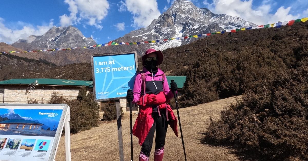
The lower part of the park is shaped by deep river gorges and forested slopes. Higher up, the landscape turns into steep ridges, glacial valleys, and ice‑scoured basins typical of the Everest region.
The journey to Sagarmatha National Park begins with a flight to Lukla. From Lukla, the trail passes through villages like Phakding, Monjo, and Namche Bazaar and moves deeper into the park. Monjo is the main national park checkpoint.Namche Bazaar is the region’s main Sherpa town and an acclimatization stop. From Namche, trails branch out toward Everest Base Camp, Gokyo Lakes, and the Everest Three Passes route.
You can buy the Sagarmatha National Park entry permit at the Nepal Tourism Board office in Kathmandu or at the park counter in Monjo.
How to Reach Sagarmatha National Park?
You reach Sagarmatha National Park in Nepal by flying to Lukla and then trekking in. There are also overland‑and‑walk options for those who want to avoid or reduce flights.
By Flight to Lukla (Most Common)
The fastest and most popular way to reach Sagarmatha National Park is a domestic flight from Kathmandu to Lukla (Tenzing–Hillary Airport). The flight takes about 35 minutes and gives close‑up views of the Himalayas on a clear day.
In peak seasons (March to May and September to November), some flights operate from Manthali Airport in Ramechhap instead of Kathmandu. You drive 4-5 hours from Kathmandu to Manthali, then take a short flight to Lukla.
By Helicopter
If you prefer to save time or avoid the fixed‑wing flight, you can charter a helicopter to Lukla or directly into the Everest region. Helicopters usually carry a small group and take roughly 40-60 minutes from Kathmandu, depending on weather and routing.
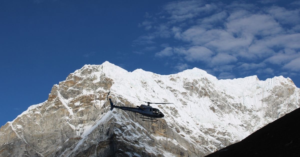
This option costs more but cuts travel time and can be useful for tight schedules or premium itineraries. After landing, you follow the same trail through Phakding and Monjo to enter the park.
By Drive + Trek (Overland Routes)
If you want less dependence on Lukla flights, you can combine road travel with a longer trek.
- ViaPhaplu: Drive from Kathmandu toward Phaplu (in Solukhumbu), then start walking from there toward Phakding and Monjo. This adds days but reduces flight risk and gives a more gradual climb.
- ViaJiri: The classic old Everest route starts with a drive to Jiri, then several extra trekking days before joining the main Lukla–Namche trekking routes. This option suits travelers who want a longer, steadier approach and fewer flight concerns.
All these routes meet at the same park entry point at Monjo, where you show your Sagarmatha National Park permit.
History of Sagarmatha National Park
Long before trekkers called this a “bucket‑list” place, the Everest region was home to Sherpa communities. They lived here for generations, farming, trading, herding animals, and following Buddhist traditions. For them, these mountains were their sacred land, more than just about views.
The idea to protect this area started in the early 1970s. In 1973, the plan for Sagarmatha National Park was announced at a global wildlife meeting in Bonn, Germany. The goal was to save the Everest ecosystem, its rare wildlife, and the Sherpa culture tied to these valleys.
Thus, Sagarmatha National Park was officially created on 19 July 1976, covering 1,148 km² in the Solukhumbu district of eastern Nepal. Later, it was listed in UNESCO World Heritage Site in 1979 as Nepal’s first Natural World Heritage Site. In 2002, a buffer zone of 275 km² was added around the park to help local communities take part in conservation and benefit from tourism. In 2007, the Gokyo Lakes were recognized as an important wetland under the Ramsar Convention.
The name “Sagarmatha” comes from two Nepali words: sagar (sky) and matha (head/forehead). It means “forehead of the sky” and is the Nepali name for Mount Everest.
Why Is Sagarmatha National Park a UNESCO World Heritage Site?
Sagarmatha National Park is a UNESCO World Heritage Site because it has both outstanding natural beauty and important cultural value. UNESCO gave it this status mainly for its outstanding mountain scenery.
The park holds Mount Everest (8,848.86 m), the tallest mountain or peak in the world, along with other famous peaks like Lhotse, Nuptse, and Ama Dablam. Deep glacial valleys, steep ridges, and massive ice systems such as the Khumbu Glacier create a dramatic high‑mountain landscape that looks unlike almost anywhere else.
Beyond the peak, the park also protects fragile habitats for rare wildlife, including snow leopards, red pandas, musk deer, and Himalayan tahr. Lower areas have forests of pine, fir, birch, juniper, and rhododendron. Higher up, trees give way to shrubs, mosses, lichens, and alpine grasses. This range of ecosystems in one protected area is scientifically and visually exceptional.
Equally beautiful is local culture. The park is home to the Sherpa people. Sherpa villages, Buddhist monasteries (like Tengboche), and traditional land‑use practices are part of what makes this region unique. UNESCO status helps bring global attention, funding, and guidelines that support better conservation, trail management, and waste handling. It also encourages tourism models that respect local culture and give communities a stronger voice in how their land is used.
Flora and Fauna of Sagarmatha National Park
Sagarmatha National Park holds a surprising mix of plant and animal life, even though much of it looks like bare rock and ice at first glance. From rhododendron forests in the lower valleys to mosses and lichens near the glaciers, each elevation zone supports different species. These habitats also shelter some of the Himalayas’ most iconic mammals and birds, many of which are rare or hard to spot.
Let's take a look at wildlife and plant species found inside this protected area:
Rare and Endangered Wildlife
Sagarmatha National Park is home to some of the most famous Himalayan animals. The snow leopard, a top predator of high, rocky terrain, is the park’s most well‑known mammal, but seeing one is very rare. Himalayan tahr, with thick coats and curved horns, are more often spotted on steep slopes above the tree line.
Musk deer live in subalpine and alpine zones and are very shy. Red pandas live in cooler, forested areas lower in the park. Himalayan black bears and langur monkeys can also be found in the wooded valleys.
Likewise, birdlife is rich and often easier to see than mammals. The Himalayan monal (Nepal’s national bird), blood pheasant, and snow partridge add color to the slopes. Large birds like the Himalayan griffon and bearded vulture circle above the valleys.
You cannot promise wildlife sightings, and that is part of what keeps the area feeling wild. Move quietly, keep your distance, and follow your guide’s advice so you do not disturb animals, especially in sensitive high‑altitude areas.
| Wildlife | Conservation Status | Best Chance to Spot |
|---|
| Snow Leopard | Endangered | High, rocky slopes above 4,000 m; very rare |
| Red Panda | Endangered | Temperate forests with bamboo, lower valleys |
| Himalayan Tahr | Vulnerable | Steep grassy slopes and cliffs above tree line |
| Musk Deer | Vulnerable | Subalpine and alpine scrub, often at dawn/dusk |
| Himalayan Black Bear | Vulnerable | Forested zones, especially in lower to mid areas |
| Himalayan Monal | Not threatened | Rhododendron and oak forests, mid‑altitude trails |
| Blood Pheasant | Near threatened | High shrub zones and alpine scrub |
| Himalayan Griffon | Not threatened | Open valleys and ridges, often soaring |
Unique Plants and Forest Types by Elevation
Many people think the Everest region is only rock and ice. In fact, Sagarmatha has clear plant zones that change with altitude.
In the lower valleys (up to around 3,000 m), temperate forests of blue pine, hemlock, fir, birch, juniper, and rhododendron line the trails. In spring, rhododendron bushes bloom in red, pink, and white, creating a striking contrast against dark forest and distant snow peaks.
Between about 3,000 and 4,000 m, tall trees start to thin out. Subalpine forests of fir, birch, and rhododendron mix with open slopes covered in shrubs and alpine grasses. As you climb higher, plants become shorter and tougher.
Above the tree line (around 4,000 m and up), the landscape turns into alpine meadows, rocky slopes, and glacier approaches. Here, only hardy grasses, mosses, lichens, and low shrubs survive the cold, wind, and thin air. Even above 5,000 m, small, specialized plants can be found clinging to rock crevices, adapted to extreme conditions.
This quick change from forest to alpine to near‑barren ground over a short vertical distance is one reason the park is so important for biodiversity.
| Elevation Zone | Typical Landscape | Common Plant Life | Notes |
|---|
| Lower region | Forested valleys and village trails | Pine, hemlock, birch, rhododendron | Richest forest zone; best in spring for blooms |
| Mid‑altitude region | Mixed woodland and open slopes | Fir, juniper, shrubs, alpine grasses | Transition zone; trees give way to scrub and grass |
| High‑altitude region | Alpine meadows, rocky slopes, glaciers | Mosses, lichens, sparse alpine vegetation | Harsh climate; only low, hardy plants survive |
Conservation Efforts and Biodiversity Highlights
Conservation in Sagarmatha focuses on protecting both nature and local ways of life. Rangers and staff work on anti‑poaching patrols, forest protection, and waste management along popular trails. The buffer zone, added in 2002, helps villages take part in decisions about tourism, grazing, and resource use.
Similarly, UNESCO World Heritage status brings international attention and support for these efforts, from better planning to projects that promote clean energy and sustainable tourism. The goal is to keep the landscape healthy for wildlife, forests, and Sherpa communities together.
Popular Trek Inside Sagarmatha National Park
Sagarmatha National Park holds some of the most famous trekking routes in the world. All of them start with a flight to Lukla and then follow trails through Sherpa villages, forests, and high valleys before reaching iconic viewpoints, lakes, or passes. The popular trekking routes within the Sagarmatha National Park are as follows:
Everest Base Camp Trek

The Everest Base Camp (EBC) trek is the classic route in Sagarmatha. It takes you from lower valleys up to the foot of the world’s highest mountain, with stops in popular villages like Namche, Tengboche, Dingboche, Lobuche, and Gorakshep. The trek combines culture, scenery, and a steady climb that builds to two main highlights: Everest Base Camp and the sunrise viewpoint at Kala Patthar.
This route suits first‑time visitors to the Everest region who want the iconic experience and are okay with busier trails in peak season.
12 days Everest Base Camp Trek itinerary:
| Day | Route | Altitude (m) | Trek Distance (km) | Trek Time | Overnight | Highlights |
|---|
| 1 | Kathmandu → Lukla → Phakding | 2,860 → 2,610 | 6.2 | 3-4 hours | Phakding | Scenic mountain flight, Dudh Koshi Valley |
| 2 | Phakding → Namche Bazaar | 2,610 → 3,440 | 10-12 | 5-6 hours | Namche | Steep climb, first big Everest views |
| 3 | Acclimatization in Namche | 3,440 | Short hike | 3-4 hours | Namche | Visit museum, hike to Syangboche or Everest View |
| 4 | Namche → Tengboche | 3,440 → 3,860 | 9.2 | 5 hours | Tengboche | Rhododendron forest, Tengboche Monastery |
| 5 | Tengboche → Dingboche | 3,867 → 4,410 | 12 | 5-6 hours | Dingboche | Enter Imja Valley, Ama Dablam views |
| 6 | Acclimatization in Dingboche | 4,410 | Short hike | 3-4 hours | Dingboche | Hike to Nangkartshang Ridge |
| 7 | Dingboche → Lobuche | 4,410 → 4,940 | 8.5 | 4-5 hours | Lobuche | Memorials at Thukla, close‑up Himalayan giants |
| 8 | Lobuche → Gorakshep → EBC → Gorakshep | 4,940 → 5,164 → 5,364 → 5,164 | 15 | 7 hours | Gorakshep | Reach Everest Base Camp |
| 9 | Kala Patthar → Pangboche | 5,545 → 3,930 | 18 | 8-9 hours | Pangboche | Sunrise over Everest, long descent |
| 10 | Pangboche → Namche | 3,930→ 3,440 | 10 | 5-6 hours | Namche | Retrace main trail |
| 11 | Namche → Lukla | 3,440 → 2,860 | 16 | 7-8 hours | Lukla | Final day on trail |
| 12 | Lukla → Kathmandu | 1,400 | Flight | 35 min | Kathmandu | End of trek |
Gokyo Lakes Trek
The Gokyo Lakes Trek is a quieter alternative to EBC that focuses on turquoise high‑altitude Gokyo lakes, glacier views, and the summit of Gokyo Ri. The route follows the first section of the EBC trail up to Namche, then branches west into the Gokyo Valley. It feels less like a race to a single milestone and more like a slow immersion in high‑mountain scenery.
This trek suits travelers who want stunning views with fewer crowds and are happy to trade the EBC label for lakes and a different perspective on Everest, Lhotse, Makalu, and Cho Oyu.
11 days Gokyo Lakes Trek Itinerary:
| Day | Route | Altitude (m) | Trek Distance (km) | Trek Time | Overnight | Highlights |
|---|
| 1 | Kathmandu → Lukla → Phakding | 2,860 → 2,610 | 6.2 | 3-4 hours | Phakding | Scenic mountain flight, Dudh Koshi Valley |
| 2 | Phakding → Namche Bazaar | 2,610 → 3,440 | 10-12 | 5-6 hours | Namche | Steep climb, first big Everest views |
| 3 | Acclimatization in Namche | 3,440 | Short hike | 3-4 hours | Namche | Visit museum, hike to Syangboche or Everest View |
| 4 | Namche → Dole | 3,440 → 4,200 | 11 | 5-6 hours | Dole | Leave the main EBC trail, enter Gokyo Valley |
| 5 | Dole → Machhermo | 4,200 → 4,470 | 7 | 3-4 hours | Machhermo | Open valley, closer to lakes |
| 6 | Machhermo → Gokyo | 4,470 → 4,790 | 6 | 3 hours | Gokyo | First Gokyo Lake in view |
| 7 | Explore Gokyo Lakes & Gokyo Ri | 4,790 → 5,357 | 6-10 (side trips) | 5-7 hours | Gokyo | 3rd, 4th, 5th lakes; sunrise from Gokyo Ri |
| 8 | Gokyo → Dole | 4,790 → 4,200 | 13 | 5-6 hours | Dole | Descend through the valley |
| 9 | Dole→ Namche | 4,200 → 3,440 | 11 | 5 hours | Namche | Rejoin main trail |
| 10 | Namche → Lukla | 3,440 → 2,860 | 16 | 7-8 hours | Lukla | Final day on trail |
| 11 | Lukla → Kathmandu | 1,400 | Flight | 35 min | Kathmandu | End of trek |
Create Your Own Everest Trip
Choose your destination, trekking route, travel dates, pace, and services to build an Everest adventure that fits your plans.
Three Passes Trek
The Everest Three Passes Trek is the big high‑altitude circuit in Sagarmatha. It links the main valleys of Khumbu by crossing Kongma La, Cho La, and Renjo La, and usually includes both Everest Base Camp and the Gokyo Lakes. This route offers more variety, a more remote feeling, and more physical challenge than the standard EBC trail.
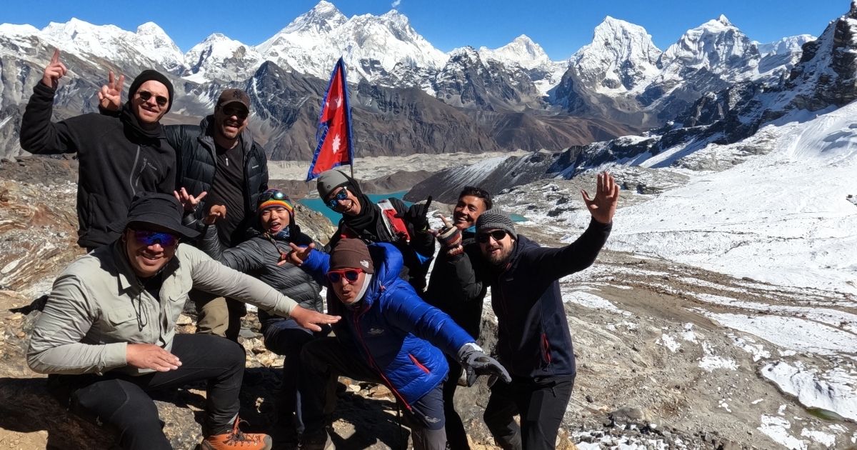
It is best for experienced or very well‑prepared trekkers who want a complete Everest experience with multiple passes, glaciers, and long days at altitude.
17 days Everest Three High Pass Trek itinerary:
Day | Route | Altitude (m) | Trek Distance (km) | Trek Time | Overnight | Highlights |
1 | Kathmandu → Lukla → Phakding | 2,860 → 2,610 | 6.2 | 3-4 hours | Phakding | Scenic mountain flight, Dudh Koshi Valley |
2 | Phakding → Namche Bazaar | 2,610 → 3,440 | 10-12 | 5-6 hours | Namche | Steep climb, first big Everest views |
3 | Acclimatization in Namche | 3,440 | Short hike | 3-4 hours | Namche | Visit museum, hike to Syangboche or Everest View |
4 | Namche → Tengboche | 3,440 → 3,860 | 9.2 | 5 hours | Tengboche | Rhododendron forest, Tengboche Monastery |
5 | Tengboche → Dingboche | 3,867 → 4,410 | 12 | 5-6 hours | Dingboche | Enter Imja Valley, Ama Dablam views |
6 | Acclimatization in Dingboche | 4,410 | Short hike | 3-4 hours | Dingboche | Hike to Nangkartshang Ridge |
7 | Dingboche → Chhukung | 4,410 → 4,730 | 4.5 | 2-3 hours | Chhukung | Prep for Kongma La |
8 | Chhukung → Kongma La → Lobuche | 4,730 → 5,535 → 4,940 | 13 | 8 hours | Lobuche | First high pass |
9 | Lobuche → Gorakshep → EBC → Gorakshep | 4,940 → 5,164 → 5,364 | 17 | 7ou hrs | Gorakshep | Everest Base Camp |
10 | Kala Patthar → Dzongla | 5,545 → 4,830 | 10.5 | 7-8 hours | Dzongla | Sunrise over Everest, descend |
11 | Dzongla → Cho La → Thagnak | 4,830 → 5,420 → 4,356 | 9 | 7 hours | Thagnak | Glacier pass crossing |
12 | Thagnak → Gokyo | 4,356 → 4,790 | 4-5 | 4 hours | Gokyo | Reach Gokyo Valley |
13 | Explore Gokyo Lakes & Gokyo Ri | 4,790 → 5,357 | 1.5 | 2 hours | Gokyo | Lakes and panoramic summit |
14 | Gokyo → Renjo La Pass → Lungden | 4,790 → 5,360 → 4,400 | 10-12 | 6-8 hours | Lungden | Third and often quietest pass |
15 | Lungden → Namche Bazaar | 4,400 → 3,440 | 15 | 6 hours | Namche | Return to main trail |
16 | Namche → Lukla | 3,440 → 2,860 | 16 | 7-8 hours | Lukla | Final day on trail |
17 | Lukla → Kathmandu | 1,400 | Flight | 35 min | Kathmandu | End of trek |
Note: Exact order of passes and side trips can vary by operator and season.
Everest View Trek
The Everest View Trek is a shorter option for travelers who want big mountain scenery without going all the way to Base Camp. The trek route follows the main EBC trail up to Namche, with extra time for viewpoints like Everest View Hotel.
This trek suits people with limited time, families, or first‑timers who want a taste of the Khumbu without the full altitude and length of EBC.
7 days Everest View Trek itinerary:
Day | Route | Altitude (m) | Trek Distance (km) | Trek Time | Overnight | Highlights |
1 | Kathmandu → Lukla → Phakding | 2,860 → 2,610 | 6.2 | 3-4 hours | Phakding | Scenic mountain flight, Dudh Koshi Valley |
2 | Phakding → Namche Bazaar | 2,610 → 3,440 | 10-12 | 5-6 hours | Namche | Steep climb, first big Everest views |
3 | Acclimatization in Namche | 3,440 | 3-4 | 3-4 hours | Namche | Visit museum, hike to Syangboche or Everest View |
4 | Namche → Tengboche | 3,440 → 3,860 | 9.2 | 5 hours | Tengboche | Rhododendron forest, Tengboche Monastery |
5 | Tengboche → Namche | 3,860 → 3,440 | 9.2 | 5 hours | Namche | Descend |
6 | Namche → Lukla | 3,440 → 2,860 | 16 | 7-8 hours | Lukla | Final day on trail |
7 | Lukla → Kathmandu | 1,400 | Flight | 35 min | Kathmandu | End of trek |
Note:Some itineraries add an extra day for a higher viewpoint or a short side trip toward Dingboche.
Island Peak Route
The Island Peak (Imja Tse) route is for trekkers who want a climbing experience in the Everest region. The trek follows the EBC trail to Dingboche or Chhukung, then adds a technical climb to the summit of Island Peak (6,189 m). You still get the classic Khumbu scenery, but with the added challenge and reward of a summit day.
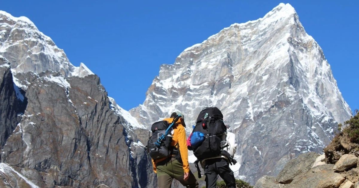
This route suits people with some high‑altitude trekking experience who are fit, comfortable with basic climbing skills, and ready for a guided peak ascent.
14 days Island Peak climbing itinerary:
Day | Route | Altitude (m) | Trek Distance (km) | Trek Time | Overnight | Highlights |
1 | Kathmandu → Lukla → Phakding | 2,860 → 2,610 | 6.2 | 3-4 hours | Phakding | Start of EBC approach |
2 | Phakding → Namche Bazaar | 2,610 → 3,440 | 10-12 | 5-6 hours | Namche | Classic Khumbu trail |
3 | Acclimatization in Namche | 3,440 | 3-4 | 3-4 hours | Namche | Everest View or Syangboche |
4 | Namche → Tengboche | 3,440 → 3,860 | 9.2 | 5 hours | Tengboche | Monastery and mountain views |
5 | Tengboche → Dingboche | 3,867 → 4,410 | 12 | 5-6 hours | Dingboche | Enter Imja Valley |
6 | Dingboche → Chhukung | 4,410 → 4,730 | 4.5 | 2-3 hours | Chhukung | Base for Island Peak |
7 | Acclimatization at Chhukung | 4,730 → 5,546 | Side hike | 3-4 | Chhukung | Short hike up towards Chhukung Ri |
8 | Chhukung → Island Peak Base Camp | 4,730 → 5,087 | 7 | 4-5 hours | Base Camp | Move into climbing zone |
9 | Base Camp→ Summit → Chhukung | 5,087 → 6,189 → 4,730 | 13 | 10-13 hours | Chhukung | Summit day with fixed ropes and descend after climb |
10 | Contingency day | | | | | |
11 | Chhukung → Tengboche | 4,730 → 3,860 | 16 | 7-8 hours | Tengboche | Return on main trail |
12 | Tengboche → Namche | 3,860 → 3,440 | 9.2 | 5 hours | Namche | Descend |
13 | Namche → Lukla | 3,440 → 2,860 | 16 | 7-8 hours | Lukla | Final day on trail |
14 | Lukla → Kathmandu | 1,400 | Flight | 35 min | Kathmandu | End of trek |
Note: Exact days vary by operator, weather, and client experience.
Permit Requirements for Sagarmatha National Park
To trek in Sagarmatha National Park, you need a Sagarmatha National Park Entry Permit and Khumbu Pasang Lhamu Rural Municipality Permit.
Sagarmatha National Park Entry Permit
This is the main conservation permit for entering the protected park area. It is checked at the park entry point near Monjo, on the trail between Phakding and Namche Bazaar. You can arrange it in Kathmandu before you fly to Lukla or get it at the Monjo checkpoint.
Sagarmatha National Park Entry Permit costs NPR 3,000 for foreign nationals, NPR 1,500 for SAARC nationals (India, Pakistan, Bangladesh, etc.), and NPR 100 for Nepali citizens. Fees are payable in Nepali rupees (NPR). You will need your passport details for the permit.
Khumbu Pasang Lhamu Rural Municipality Permit (Trek Card)
This is a local government permit for the Khumbu region, which includes the Everest Base Camp, Gokyo, and Three Passes routes. It is usually issued at Lukla/Chheplung or at checkpoints along the trail.
Khumbu Pasang Lhamu Rural Municipality Permit costs NPR 3,000. Payment is in NPR, and passport details are required.
What is the Best Time to Visit Sagarmatha National Park?
If you are searching for the best time to visit Sagarmatha National Park or the best time to trek Sagarmatha National Park, plan for March to May or September to November. Winter and monsoon have their own charm, but come with colder nights, more clouds, or wetter trails.
Spring (March to May)
Spring is one of the best seasons for trekking in the park. Days are longer, temperatures are milder than in deep winter, and the lower trails are covered with blooming rhododendrons. Mountain views are very good, especially in the mornings, and the region feels busy and positive as the main trekking season builds.
Day temperatures in the lower valleys are comfortable. Higher terrain can get cold but is still manageable. Flights to Lukla are also more reliable and operate frequently. This season suits first‑timers, photographers, and anyone who wants flowers, decent weather, and active teahouses without the peak autumn crowds.
Autumn (September to November)
Autumn is widely considered the prime trekking season in Sagarmatha. Autumn comes after the monsoon ends, so the air is clearer, the skies are deep blue, and visibility of Everest and neighboring peaks is at its best. Trails and teahouses are busiest during these months, especially on the classic Everest Base Camp route.
Days are sunny and pleasant in the lower valleys, while nights at higher altitude can drop below freezing. If your top priority is clear mountain views and stable weather, and you don’t mind more people on the trail, autumn is the best time to trek inside Sagarmatha National Park.
Winter (December to February)
Winter brings cold, crisp days and very quiet trails. Nights at higher altitude can drop well below freezing, and snow can close or slow some high sections for short periods. On clear days, the mountain views are stunning, and the region feels peaceful and remote.
This season suits well‑prepared trekkers who value solitude and dramatic snowy landscapes over warm days and busy teahouses. Nonetheless, you will need warm clothing, a good sleeping bag, and a flexible plan in case of weather changes.
Monsoon (June to August)
Monsoon is the least predictable season. Lower trails get wet, muddy, and slippery due to heavy rainfall. Clouds also hide the high peaks. Flights to Lukla are more likely to be delayed or rerouted. On the other hand, valleys are green, waterfalls are strong, and there are far fewer trekkers.
Monsoon works for flexible travelers who don’t mind rain and clouds and prefer quieter trails and lower prices. Good waterproof boots, rain gear, and extra buffer days are important if you choose this time.
Season | Months | Weather & Views | Trails & Crowds | Best For |
Spring | March, April, May | Mild days, clear mornings, rhododendron blooms | Busy but not peak; good teahouse options | First‑timers, photographers, flower lovers |
Autumn | September, October, November | Very clear skies, best mountain views | Busiest season; crowded on main routes | Travelers who prioritize views and stable weather |
Winter | December, January, February | Cold, crisp days; possible snow at height | Quiet trails; some teahouses closed | Solo trekkers, photographers, those seeking solitude |
Monsoon | June, July, August | Warm, wet, cloudy; lush green valleys | Least crowded; some flight disruptions | Budget travelers, flexible plans, off‑beat experience |
Explore trekking packages through Sagarmatha National Park, from classic Everest routes to shorter and more challenging adventures.
Rules and Regulations Inside Sagarmatha National Park
Sagarmatha National Park is a protected area and a UNESCO World Heritage Site. To keep the landscape, wildlife, and local culture safe, there are some rules that all trekkers and visitors must follow.
Some rules and regulations inside Sagarmatha National Park include:
- Carry your permits at all times: You must have your Sagarmatha National Park entry permit and the Khumbu Pasang Lhamu Rural Municipality permit (Trek Card) with you. Rangers can ask to see them at any checkpoint, especially around Monjo and Namche.
- Stay on marked trails: Walking off‑trail damages fragile vegetation and increases erosion and landslide risk. Stick to the established path, even when shortcuts look tempting.
- Do not disturb wildlife: Keep a respectful distance from animals like Himalayan tahr, musk deer, and any rare species you may see. Do not feed, chase, or try to touch them.
- Respect local culture and religious sites: Dress modestly around villages and monasteries, ask before photographing people or inside temples, and walk clockwise around chortens and prayer wheels unless local custom says otherwise.
- Pack out your own waste: You are expected to carry out all personal trash and dispose of it at designated collection points in villages like Namche or at the end of your trek. Do not leave wrappers, bottles, or food waste on the trail.
- Use teahouses and designated camping areas: Random camping is discouraged in busy zones. If you are on an expedition or a camping trek, use approved sites and follow instructions from park staff and your guide.
- No open fires in the forest: Firewood is scarce and cutting trees is prohibited. Use gas stoves for cooking and heating where allowed, and follow teahouse or camp rules about fuel.
- Travel insurance with high‑altitude and helicopter coverage: You must show proof of travel insurance that covers high‑altitude trekking and emergency helicopter evacuation up to at least 6,000 m before your permit is issued.
Conclusion
All around the world, people connect Sagarmatha National Park as a route to Everest. But it is more than that. It is a living landscape where high mountains, forests, and glaciers meet Sherpa villages, monasteries, and centuries‑old trails. Every step you take here reminds you that this region is both fragile and powerful.
If you follow the rules, travel with care, and take time to notice the details, your visit supports both conservation and local life. The memories you carry home will not only be about peaks and passes, but also about the people, culture, and quiet moments that make the Everest region unique.
FAQs About Sagarmatha National Park
How do I reach Sagarmatha National Park?
You reach Sagarmatha National Park by flying from Kathmandu to Lukla, then walk two days to the park entry at Monjo.
How do you get to Sagarmatha National Park from Kathmandu?
From Kathmandu, you take a 35-minute flight to Lukla, then trek to Phakding and Monjo. In busy months, you may drive 4-5 hours to Manthali Airport, fly to Lukla, and then follow the same trail into the park.
How many days does it take to trek to Everest Base Camp?
A standard Everest Base Camp trek takes 12-14 days of walking, or 14-16 days including travel to/from Kathmandu. Shorter and longer itineraries exist, but most people plan about two weeks on the trail for a safe, well‑paced climb.
Is Sagarmatha National Park the same as Everest Base Camp?
No. Sagarmatha National Park is the protected area that covers much of the Everest region. Everest Base Camp is one specific destination inside the park. You can trek in the park without going to EBC, for example on the Gokyo or Three Passes routes.
Do I need a guide to enter Sagarmatha National Park?
Not mandatory for all trekkers, but rules are changing. Many foreign visitors still enter with a licensed guide because permits and checkpoints often expect proper documentation.
What villages are located inside Sagarmatha National Park?
Key villages inside or on the edge of the park include Namche Bazaar, Tengboche, Dingboche, Lobuche, Gorak Shep, Thame, Khumjung, and Gokyo. These Sherpa settlements have teahouses, monasteries, and services along the main Everest, Gokyo, and Three Passes trekking routes.
What permits are required to enter Sagarmatha National Park?
You need the Sagarmatha National Park entry permit and the Khumbu Pasang Lhamu Rural Municipality permit (Trek Card) to enter Sagarmatha National Park.
What is the altitude of Sagarmatha National Park / Everest Base Camp?
The altitude of Sagarmatha National Park ranges from about 2,800 m to over 8,848.86 m above sea level. Everest Base Camp sits at 5,364 m, while the nearby Kala Patthar viewpoint is 5,545 m. Most teahouse treks stay below 5,600 m, with higher altitudes on passes and peaks.
What animals live in Sagarmatha National Park?
The park is home to snow leopards, red pandas, Himalayan tahr, musk deer, Himalayan black bears, and langur monkeys. Birdlife includes the Himalayan monal, blood pheasant, snowcock, griffon, and bearded vulture. Sightings are never guaranteed, especially for rare mammals.
How much does an Everest Base Camp trek cost in total?
EBC Trek Total cost varies by duration, style and services. Group tours often range from USD 1,400 to 2,200, while private or premium trips can be higher. Budget for permits, flights, guide/porter, food, lodging, gear, insurance, and tips when planning your total EBC budget.
What should I pack for a trek in Sagarmatha National Park?
Pack warm layers, a good down jacket, waterproof shell, trekking boots, sleeping bag (if needed), headlamp, water purification, basic first aid, and sun protection. Bring passport copies, permits, cash in NPR, and travel insurance documents in a waterproof bag.
Can you fly into Sagarmatha National Park instead of trekking?
Yes, you can fly into Sagarmatha National Park instead of trekking. You can take helicopter tours that land at points like Syangboche, Pheriche, or even Kala Patthar for short visits. However, there is no regular commercial airport inside the park. Most visitors still trek from Lukla to experience the region properly.
Is Sagarmatha National Park worth visiting without doing the full EBC trek?
Yes. Shorter treks to Namche, Tengboche, or Gokyo still offer big mountain views, Sherpa culture, and monasteries without the full EBC commitment. Families, photographers, and time‑limited travelers can enjoy the park on 5–10 day itineraries that skip Base Camp.
What is the difference between Sagarmatha National Park and Annapurna Conservation Area?
Sagarmatha National Park is a protected area and UNESCO World Heritage Site focused on the Everest region, with higher altitudes and Sherpa culture. Annapurna Conservation Area is a protected area in western Nepal, with diverse climates, many trekking options, and different ethnic communities and landscapes.
Where is the Sagarmatha National Park entry checkpoint?
The main Sagarmatha National Park entry checkpoint is at Monjo, on the trail between Phakding and Namche Bazaar. Rangers check permits and register trekkers here. You can arrange permits in Kathmandu, but you will still pass through this checkpoint on most standard routes.
Which trekking routes pass through Sagarmatha National Park?
Trekking routes that pass through Sagarmatha National Park include the Everest Base Camp trek, Gokyo Lakes trek, Everest Three Passes trek, Everest View trek, and Island Peak climb. All start from Lukla and move through villages like Namche, Tengboche, and Dingboche before branching to different high valleys and passes.
What is the best trekking route in Sagarmatha National Park besides EBC?
The best trekking routes in Sagarmatha National Park besides EBC are the Gokyo Lakes trek and the Three Passes trek. Gokyo offers turquoise lakes and Gokyo Ri views with fewer crowds. Three Passes gives a full high‑altitude circuit with EBC, Gokyo, and three challenging passes for experienced trekkers.
Can beginners or families visit Sagarmatha National Park safely?
Yes, with proper planning, beginners or families can visit Sagarmatha National Park. Shorter treks to Namche or Tengboche suit families and beginners better than the full EBC. We recommend trekking with a licensed guide, planning acclimatization days, choosing the right season, and ensuring good insurance and gear to keep the trip safe and enjoyable.


.webp)